


Product description:
Three charts of wisdom: it's a space-based sensory techniqueAl's big model intelligence analysis, which integrates the remote, 100-degree, telecommunication map navigation, and enables innovative devices for coordinated early warning of road traffic. The aim is to provide safety and security and intelligent early warning for road-related persons and vehicles on highways and urban areas, and to effectively reduce road-related risks。
Integration of advanced technologies: three charts one, red blue flash, directed acousticsRtk positioning, ai large model, internet-wide 4g module, multiple sensors, radar speed limit warning。
1. AdoptionAl's large model algorithms allow smart processing and data analysis, and achieve road-class road synergetic warning。
2. Equipment is equipped with portable designs with replacement batteries and strong and beautiful casings to ensure stable operation in adverse environments。
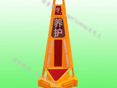
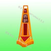
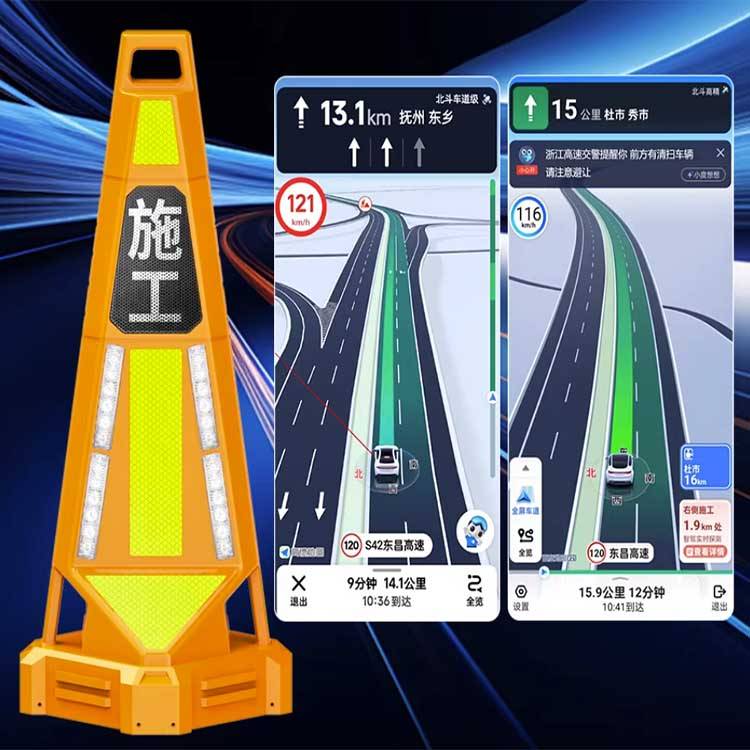
3. Road construction maintenance points at map location, construction length, speed alert, construction limit values40, 60, 80。
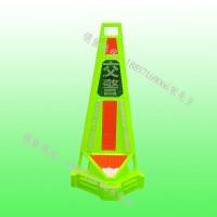
Traffic police handle traffic accidents, which can be closed on a factual basis, showing real-time accidents/blocking on maps。
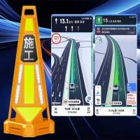
5. Long-range navigation early warning: high-terrestrial, 100-degree, telegraphic long-range navigation alert。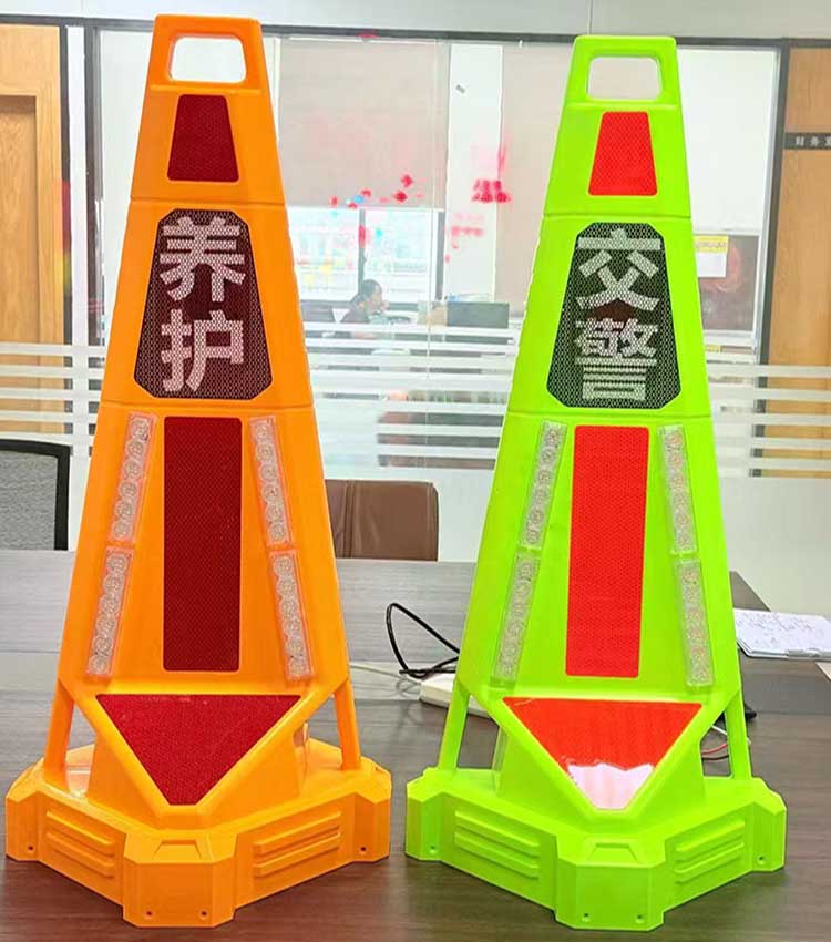
Product name: three charts of wisdom road
Model:Xh-zhlz-4a
Specifications:900* 340* 340 mm
Technical parameters:
Shell mass:(b) prc plastics
Red and blue flashes:12 light 3w/4 group
RayDa: 24ghz mm wave radar
Horns:4 40 watts
Sound level: ≥126db
Audio playing:Mp3 function
Map presentation: mobile positioning trajectory of beidou
Navigation early warning: support for goth, 100 degrees/map navigation
ElectricityPools: lithium phosphate 15ah
Data wireless connection: support2gmg network (support for internet-wide mobile/connected/telecom)
Protection level: adoptedIp66 protective design
Working hours: full electricityMore than 30 hours
Power supply: charge supportType-c, dc double charging interface
HeavyVolume: about 6kg (free weight)
Product advantages:
Easy to operate: no training required, one key start/off alert, one key on-line navigation map waiver, one key set the construction speed limit. Hard shell, hand-held, single-person quick-screened。Two minutes above: bring the al calculator module, local smart computing combined with the map platform smart analysis, and real-time updates of dynamic traffic information. Early warning data are quickly reported without manual calibration。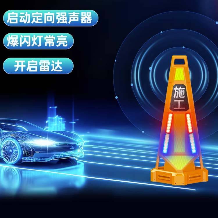
Application scene:
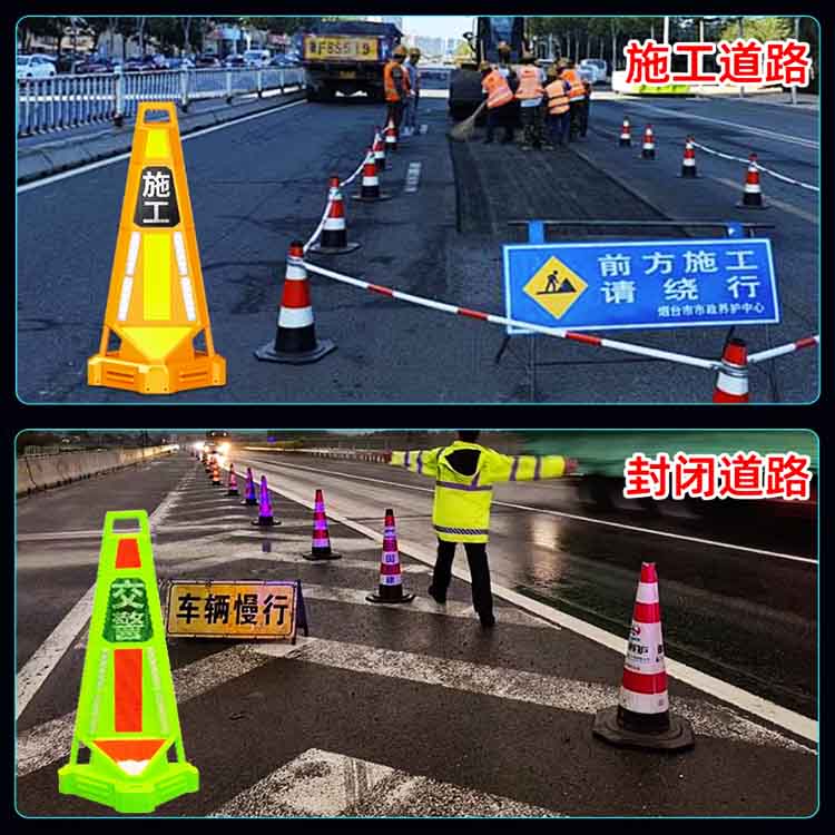
1. Maintenance of construction work on off-speed roads: markable location of construction area, display of construction duration, setting of speed limits to ensure construction safety through remote navigation software alerts and speeding alerts。
Traffic accident management: traffic police may conduct road blockages on duty, display real-time accident/blocking on maps and guide vehicles around。
3. Urban road operations: provide security early warning by applying scenarios such as maintenance of 1,000 urban roads, perimeters of construction sites, night operations, etc。
4. Severe weather response: increased warning effect in low-visibility weather conditions such as rain, fog and snow, alert drivers to road conditions。
5. The response to special incidents supports large-scale events, emergency evacuation guidelines, temporary traffic controls, barrier alerts and a variety of temporary outdoor alerts。