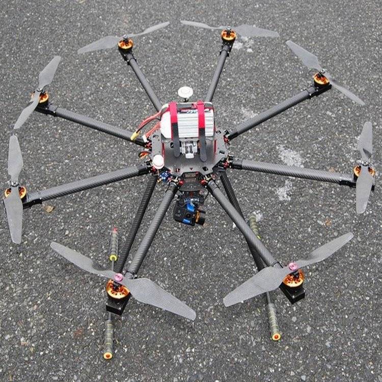
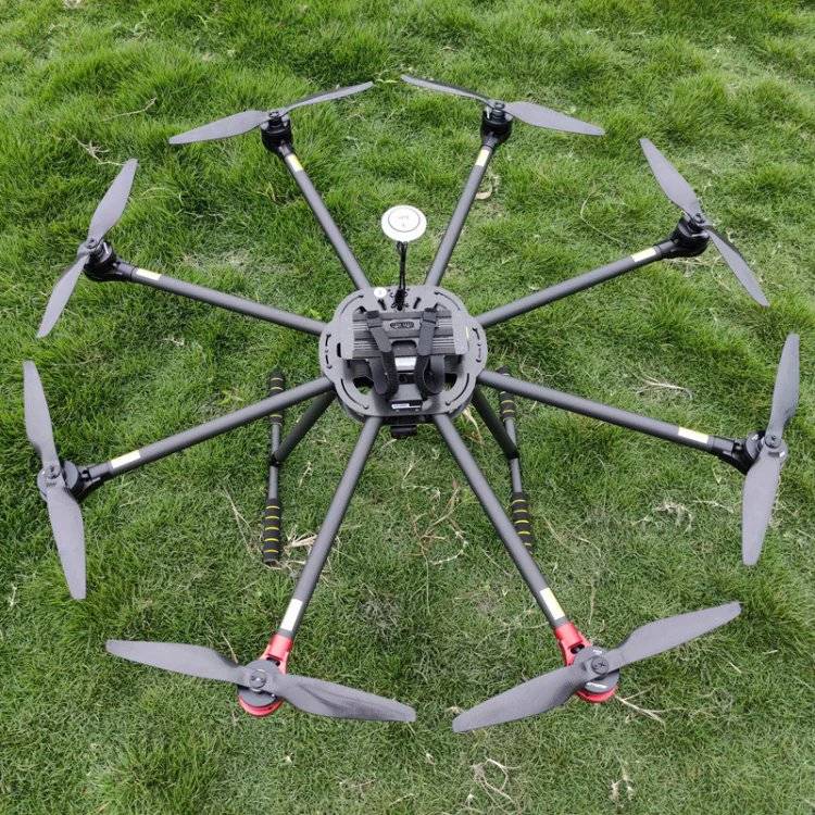
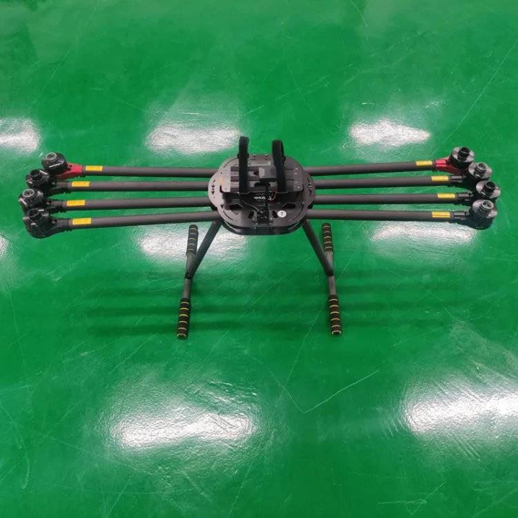
Flying vehicle z. Large take-off weight 9. 2 kg
No more than 430 x 430 x 430 mm (lxwxh)
Arcular length of the vehicle 895 mm
Z large rotation angle velocity, overlaying axis 300°/s, heading axis 100°/s
6 m/s
Decline 5 m/s
Horizontal speed of 22 m/s
Flight altitude can reach 5,000 m
Z long flight time 55 minutes
Ip protection level ip55
Z large wind resilient 12m/s
Uas operating environment temperature range at 20°c and 50°c
Visual positioning suspension accuracy vertical: ±0. 1 m (when visual positioning works) level: ±0. 3 m (when visual positioning works)
Supports the rtk positioning vehicle with rtk modules and rtk positioning capabilities, and supports access to high-precision position information via remote control to a network rtk service or rtk mobile station。
Rtk positioning suspense vertical: ±0. 1 m (rtk positioning normal working time) level: ±0. 1 m (rtk positioning normal working time)
Frequency of operation of the vehicle 2. 4000 ghz to 2. 4835 ghz, 5. 725 ghz to 5. 850 ghz
Double signal control transmission redundancy
During the autonomous landing process, the uav is able to detect the subterranean terrain, which is uneven on the ground or in the water surface, and the vehicle remains suspended, while being able to alert users via remote control software。
The ads-b function enables the flight information received by drones to analyse and obtain information on the location, altitude, direction, speed, etc. Of the manned aircraft and to compare it with the current position, altitude, direction, speed, etc. Of the vehicle, and to calculate in real time the level of risk close to the manned aircraft. Support is given to sending alert messages to users via software, depending on the level of risk。
The fuselage contains headlights and state lights. Supports the closing of remote controls to covert operations。
(b) the vehicle is equipped with a night flight light at the top and bottom to facilitate the identification of the vehicle during night flight. The night-lights can be opened or turned off manually in a remote control。
The vehicle is equipped with a recharge light at the bottom, which can be activated automatically when the light is insufficient to support the work of the lower visual system. Refilling lamps may be activated or turned off manually in a remote control。
All-way sensory systems with six-way visual systems and six-way infrared sensor systems
The drone system supports the setting of warning distance and automatic brakes at the horizontal (back and back), upper and lower levels, and vehicle avoidance can be set to stop。
The remote control side looks at both inertial measurement units (imu) inside the drone, and the real-time status arm of the compass is in place to support the arm of the machine to detect whether the arm kit is tightened, if it is not tightened to warn at the remote control end。
Smart back-to-go. Smart back-to-go. Start with a long remote control back-to-air button. After-activation aircraft will adjust the direction of the aircraft and begin to return. During the return flight, the aircraft will automatically plan the z-go-back route. Users of the return process will control the vehicle's speed and altitude avoidance barrier by hitting. Short-clicking on the remote control smart return button or the stop button allows for exit. The user can regain control of the vehicle upon the exit of the intelligent return。
If the current capacity is only sufficient to complete the return process, the remote control app will alert the user to proceed with the return. If the user does not choose within the default time of 10s, the aircraft will automatically perform a return flight. Short-clicking on the remote control smart return button or the stop button allows for exit。
Uncontrolled return may set up a vehicle that has lost control after the breakdown of the remote signal as a return, landing or suspension. When the out-of-control action is set to return, the flight will trigger the out-of-control return if the remote control and aircraft are disconnected. During the start-up phase of the uncontrollable return, the vehicle will return to its original route and will be traced back along the historical flight path in an attempt to restore the remote control connection. If the remote control link is not restored or the barrier is detected during the original return, it will exit and enter the intelligent return process. If, during the return journey, the radio signal is restored and the remote control is connected to the vehicle, the vehicle will continue to return. Upon continued return, the user can control the speed and altitude of the flight through the remote control and can cancel the return by pressing the remote control smart return button or pressing the stop button。
Fpv camera fpv camera, resolution 1920 x 1080,30fps map antenna number
Fax quality 1080p/30fps
Line function supports flight point flight, construction of drawings, tilting of photographs, flight belts, multiple routes. Support for 2d and 3d modelling。
Online task recording supports online task recording, which allows for the recording of vehicle location, photographing and other information during flight to automatically generate flight routes。
Precise reshooting allows for the selection of objects of interest on each point's photograph, learning algorithms through front-end machines of images, and identifying object characteristics. When the course is repeated, the target can be searched automatically to ensure consistency in each photograph taken。
The high limit distance settings support the setting of high limits and long distances at the remote control end. The upper limit will limit the vehicle's z flight altitude; the upper limit will limit the vehicle's z flight radius (with a circular point of return)。
Customized watermarks the committee, through remote control, can customise information on aircraft type, sn code, longitude, date time, etc., and can customise watermarks。
The ultra-clear matrix captures a range selected in a wide-angle camera image, and the cloud towers will automatically turn and take several pictures of the 2000 megapixels from the selected area with the current zoom camera rate。
Panoramic photos
Integrated design for screen remote control, remote control and display screen
Remote control interface with hdmi video output interface, sd slot, usb interface
Z large signal effective distance (no interference, no shield) up to 20 km
The remote control will last for no less than three hours, the inner cell + the external battery for no less than six hours
Camera requests:
Weight: 920 ± 5 g
System function: 26 w
Protection level: ip54
Working temperature: 20°c to 50°c
Storage temperature: 20°c to 60°c
Cloud table parameters
Stabilization system: 3 axes (substrate, roll, horizontal)
Angle dithering: suspended: ±0. 002°, flight: ±0. 004°
Installation: dji skyport dismantling
Mechanical angle range: tilting: -132. 5° to 73°, rolling: ±60°, altitude: ±328°
Controlable rotation range: overturn: 120° to 60°
Diverse: ±320°
Working mode: follow, freedom, return, focus camera
Image sensor: 1/18. 8 inches cmos, effective pixels: 40 million
Camera: actual focal length: 7. 1 mm to 172 mm (equivalent focal length: 33. 4 mm to 809. 3 mm)
Aperture: f/1. 6 to f/5. 2
Dfov: 66. 7° to 2. 9°
Focus mode: mf, afc, afs
Exposure mode: manual exposure, automatic exposure of the program
Exposure compensation: ±3. 0 (in 1/3 steps)
Photometric mode: spot light, average light support
Video resolution
Normal: 3840 x 2160@30fps, 1920 x 1080@30fps
Night view: 1920 x 1080@25fps, 1920 x 1080@15fps, 1920 x 1080@5fps wide-angle camera
Image sensor
1/1. 3 in cmos, effective pixel 48 million
Camera
Actual focal length: 6. 72 mm (equivalent focal length: 24 mm)
Aperture: f/1. 7
Dfov: 82. 1°
Focus mode
Mf, afc, afs
Exposure mode
Manual exposure, automatic exposure
Exposure compensation
±3. 0 (in 1/3 steps)
Photometric mode
Point light, average light
Light locking
Support
Electronic fast door speed
18,000 seconds to 2 seconds
Thermal imaging camera
Thermal imaging sensors
Non-refrigerated argon oxide (vox) microthermal radiometer
Camera
Focal length: 24 mm (equivalent focal length: 52 mm)
Aperture: f/0. 95
Dfov: 45. 2°
Digital focus equivalent multiple
32 times
Video resolution
1280 x 1024@30fps
Video format
Mp4
Video subtitles
Support
Video encoding and code rate policy
H264, h265
Cbr, vbr
Photo resolution
1280 x 1024
Photo format
R-jpeg
It's like space
12 meters
Wavelength range
8m to 14m
Noise equivalent temperature (netd)
≤50 mk@f/1. 0
Temperature measurement
Temperature measure, regional temperature measure, centre point temperature measure
Temperature range
High gain: 20 °c to 150 °c, 20 °c to 450 °c (after installation of infrared decay mirrors)
Low gain: 0 °c to 600 °c, 0 °c to 1600 °c (after infrared decay mirror installed)
Laser ranger
Wavelength: 905 nm
Measurement range: 3 m to 3000 m
Quantities of common objects: meadow 2000 m, woodland 1900 m, road 1700 m
Measuring precision
≤500 m: ± (0. 2 m + measured distance x 0. 15%)
> 500 m: ±1. 0 m
Laser light size
100 m: approximately 50 mm x 450 mm
1000 m: approximately 450 mm x 4500 mm data storage
Supported storage card type
Support for u3/class10/v30 and above microsd cards
Infrared analysis software infrared thermal analysis tool 3 (dtat 3. 0)