The city of paul is a historic city situated in the middle and west of hebei province。
During the original social period, the trajectory of human activity and the development of a culture of reverence emerged within the country。
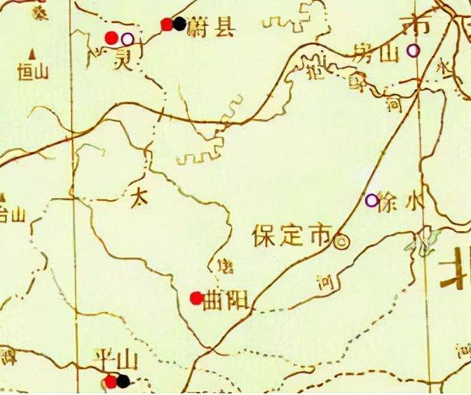
Map of the original social period
During the western week, the territory was under the jurisdiction of one of the nine states, the two states in the north, zozhou and kyushu。
During the spring and autumn period, the western state of the country continued its incursions eastward, the southern region was occupied by the state of the country and the country of fresh danger, and the north was owned by the state of yan。
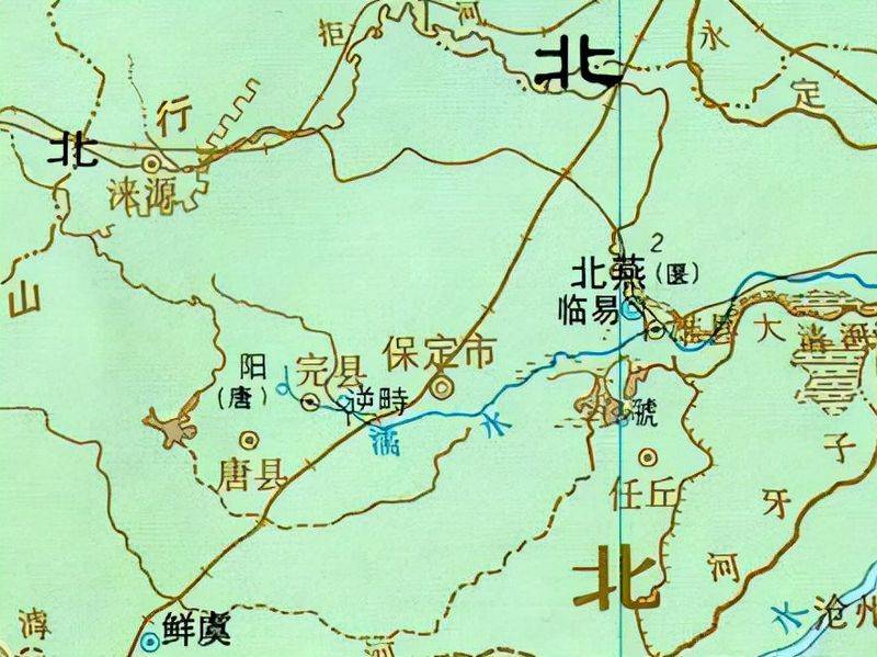
Map of spring and autumn
At the time of the war, king yan built a popular town on the northern bank of the river known as the town of grazing horses. Subsequently, qi fought against yan and occupied san qi, with parts of the area occupied. Later, after civil strife in yan, the qi united mountain state attacked the qi country and divided it, the north was occupied by zi and the south by zishan。
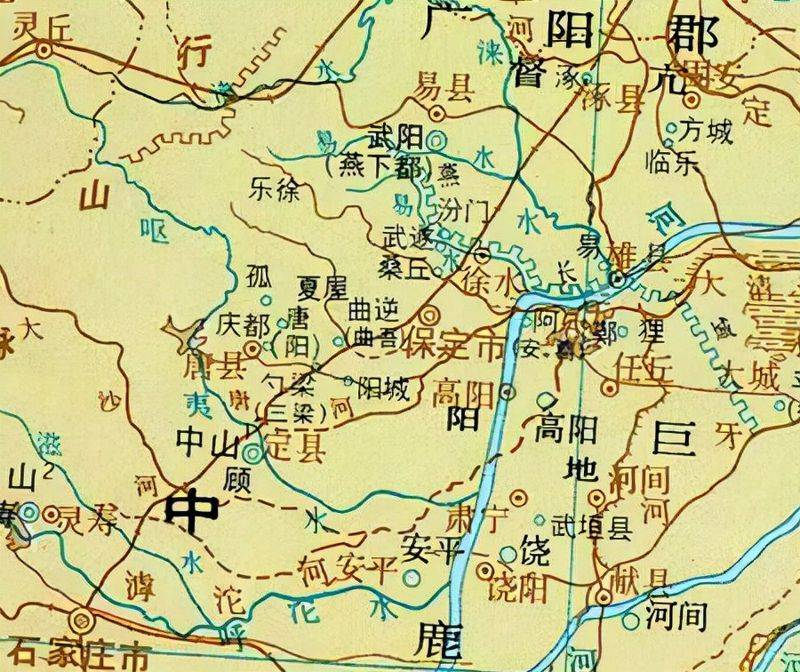
Maps of the war nation
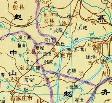
A map of the men by deer during the war
During the qin dynasty, after the unification of the country, the separation of seals was abolished and the county and county levels were introduced。
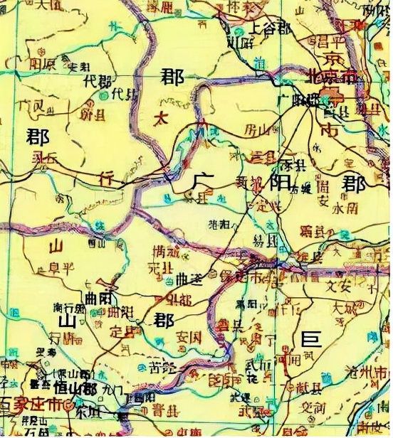
Map of the qin dynasty
During the western han period, changshan county and china mountain state in the country belonged to the department of stinging history of yuzhou, the department of stingling history of kyaw county, and the department of stingling history of dynasty county。
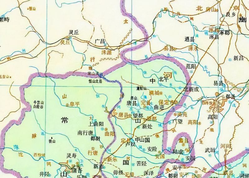
In the west han period, the jurisdiction of yuzhou's stabbing department
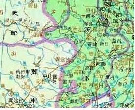
In the west han period, the jurisdiction of the queen's department
During the east han period, there was a change in the region, with changshan state, china mountain state, the river state being transferred to the state department for the history of stingling, and the state for the county of stingling。
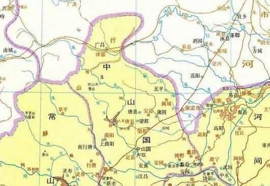
In the east han era, the jurisdiction of yuzhou's stabbing department
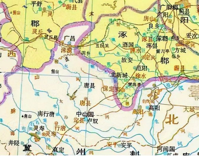
In the east han period, the jurisdiction of the quinzhou department of stinging history
During the tri-national period, changshan county, middle mountain state and river county in wei were under the jurisdiction of zhouzhou and fanyang county。
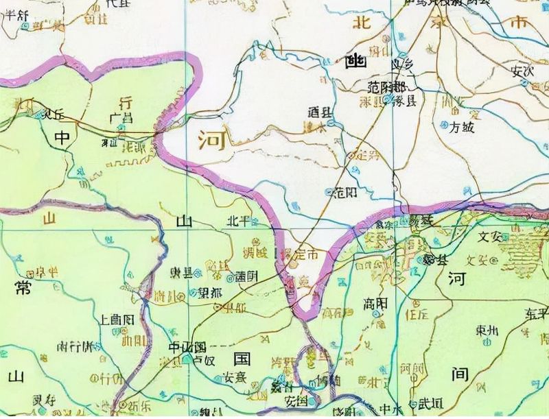
During the trinational period, parts of the area were under the jurisdiction of yuzhou
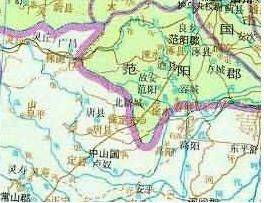
During the trinational period, part of the area was under the jurisdiction of the quintons
During the western jinh period, changshan county, nakayama state and gaoyang county were under the jurisdiction of yuzhou and daishi county and fanyang state。
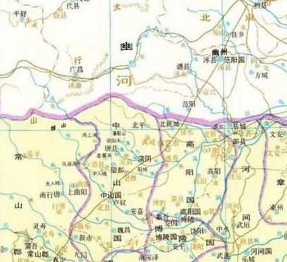
Map 1 of the western jinn period
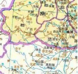
Map 2 of the western jinn period
In the north-south era and in the north-west, the territory was under the jurisdiction of the provinces of zhuang, tingzhou, yanzhou and gyuzhou respectively。
It was divided from new town county to set up kiyoshi county to be known as kiyo river, at the beginning of the pre-established county。
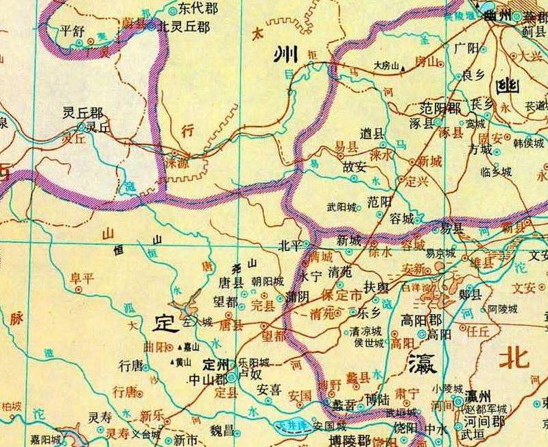
Map of north and south, wei times
During the five generations of the ten kingdoms, in post-tang, the establishment of the bong-chui army in qing dynasty was transformed into the state of thailand, the beginning of the guaranteed state。
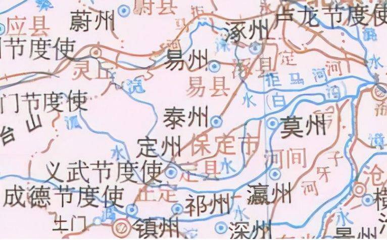
Five generations, ten generations, post-tunt
During the northern song period, the territory was divided into two parts, the north and the south, the north was occupied by liao and the south was under the jurisdiction of the northern song。
Qing zheng zheng, the ancestral home of song taizu zhao zhou zheng zheng, is located on the borderline of song zhao, and is geographically important for a major military town, thus setting up the army of sierra leone with the intention of defending the border。
Later, the prs was transformed into a paw region。
There are two branches: the paou, ting, pu, young ning, sun an, yu, ansu and guang sin。
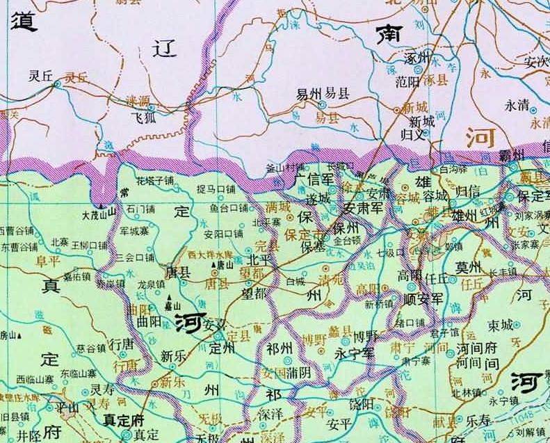
Map of the north song period
During the southern song era, the song kings and the kim soldiers attacked paozhou, where kim followed the song dynasty mechanism and remained known as paozhou。
There are yizhou, yizhou, yuzhou, anzhou, zhouzhou, quizhou, tingzhou, zheng dynasty, pouzhou, suzhou and ansuzhou。
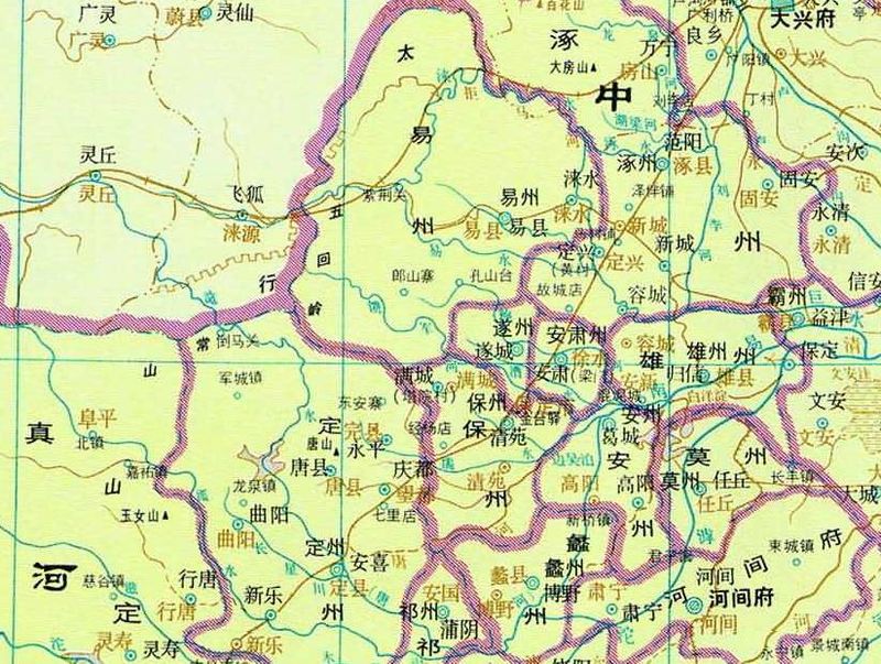
Map of the southern song
During the time of china, genghis khan led the mongol army to attack the country
In 1213 a. D., the town of pao state was breached and the pond was destroyed。
Subsequently, after the reconstruction of the town of paou state, the name was changed to skylight, skyline road and roadway。
Within the territory, such areas as secure roads, secure roads, major roads and roadways fall under their respective jurisdiction。
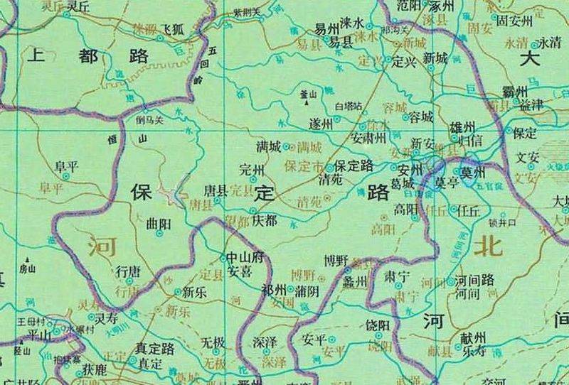
Maps of the eternity
During the period of the ming dynasty, the road was changed to the capital known as paoyang county。
The guaranteed inspectorate was established in 1515 a. D. And the security was changed to governor at the end of the year。
It belongs to the capital, the capital and the capital. It's under kyoshi。
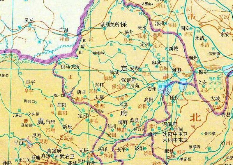
Map of the ming dynasty
In the qing dynasty, the office was moved from regular to secure, making it the capital of the province. Later, he became governor-general。
Areas of the national territory fall under the jurisdiction of the capital, the canton, the canton, the canton and the capital。
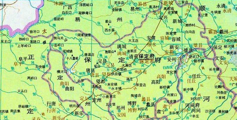
Maps of the qing dynasty