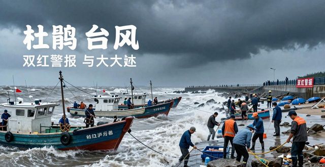
Xinhua network, beijing, september 28thTyphoonThe national ocean prediction station continues to publish waves today at 1600 hoursStorm surgeRedAlertI don't know。
On the 29th day, the national ocean forecaster announced that, under the influence of the dooku, there have been waves from 8 to 13 metres east of taiwan to the zhejiang region, from 4 to 6 metres south of the east sea to the sea near the diaoyu island, from the taiwan strait to the zhejiang southFujianThere was a wave of about 3 metres along the northern coast. At the same time, there has been a storm surge of 30 to 100 centimetres from the yangtze mouth to the coast of fujianzhou during the day, in which zhejiang ryan, zhengjiang and fujian chongwu positions reached their local orange alert levels this morning。
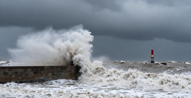
It is expected that after crossing the island, the dooku will land again on the fujian coast between the morning of 29 and noon, potentially overlapping with coastal astronomical peaks, with severe storm surges and wave disasters。
As a result of the combined effect of the “duplex” and cold air, the national ocean forecaster predicts that between the night of 28 and the day of 29 days there will be a wave of 8 to 13 metres from the sea east of taiwan to the zoo zone, a wave of 6 to 9 metres from the south-east sea, the sea near the diao islands, and the taiwan strait; a wave of 4 to 6 metres from the southern sea off the zhejiang river and the northern sea off fujian zhejiang; a wave of 3 to 4. 4 metres from the southern sea off the zhejiang river; and a wave of 2 to 3. 5 metres from the upper sea zhejiang。
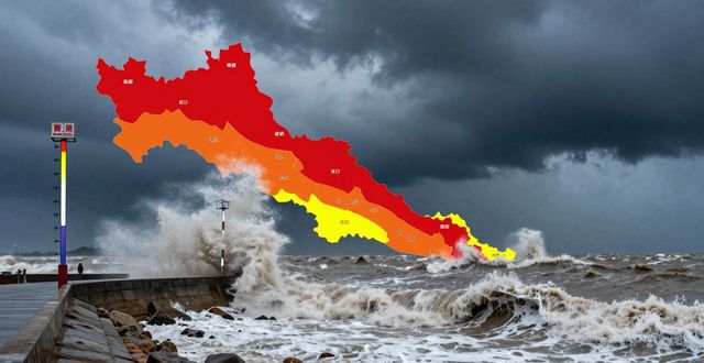
The national ocean forecasting bureau projects that between the afternoon of 28 and the afternoon of 29, there will be a 50 to 130 centimetre storm surge from yangtze to the coast of zhejiang tai county, between 80 and 200 centimetres from wenzhou to the coast of guantao province, and between 50 and 130 centimetres from fujian south-central coast. The tide stations in the above-mentioned sections will have peaks in excess of local alert levels on the night of 28 and the morning of 29, respectively. In zhejiang wenzhou and fujian fukuda, quanzhou and xiamen storm surge warning level is red, in zhejiang ka xing, hangzhou, shao xing, taizhou and fujianingde, in zhuangzhou storm alert level is orange and in shanghai and zhejiang ningbo, and in hongshan。
As the sea coast is currently at its highest astronomical tide throughout the year, the national ocean forecasting service warns that ships sailing or operating at sea must return to port in a timely manner, that coastal breeders must strengthen facilities early and withdraw as soon as possible, and that, subject to ensuring the safety of personnel, it is necessary to strengthen the inspection and maintenance of installations, such as sea walls, water gates, etc., and sea walls in vulnerable and dangerous areas should be strengthened in a timely manner, and that low-lying areas along the coast must be protected from seawater flooding and preparation for tide。