On 28 december, the central radio and television station " spring festival gala 2026 " was released in four separate venues: harbin heilongjiang, yiu zhejiang, anhui yi, sichuan yibin。
The four main branches of the spring (harbin, yiu, fatty, hui bin) cover four major geographical blocks in the east, centre, west and north-east of china, linking the core geographical points of secondary schools, such as climate, topography, hydrology, location, industry and regional development, and providing direct access to teaching materials and mid-test logic。
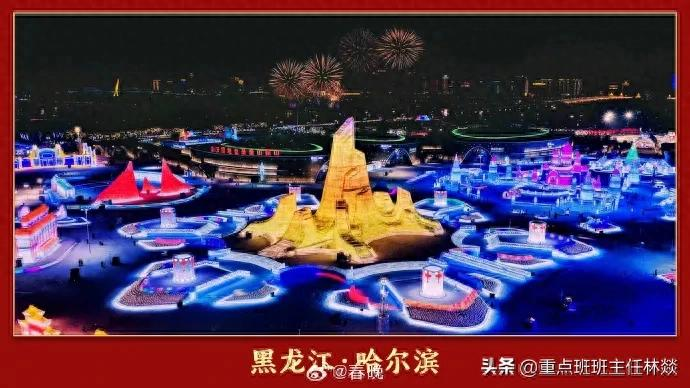
Harbin: geo-code latitudes and climate in ice and snow capital: near 45° n, temperate monsoon climate, average january temperature - 19° c ~ 15° c, five months in winter, depth of snow up to 20-30 cm, providing natural conditions for the ice and snow world, corresponding to the “climate-type distribution and characteristics” test. Topography and rivers: east of the pine plain, through the pines river, with springs of 4 to 5 months (seasonal snow-melting) and summers of 7 to 8 months (rainfalls), and winter ice periods of approximately 120 days, reflecting “river hydrological characteristics and types of recharge”. Regional linkages: north-east asia logistics hub, china-russian trade window, linking border trade and regional synergy development knowledge point. Linked to the theme of spring and evening, “ice warm winters”, displaying the north and winter folklore。
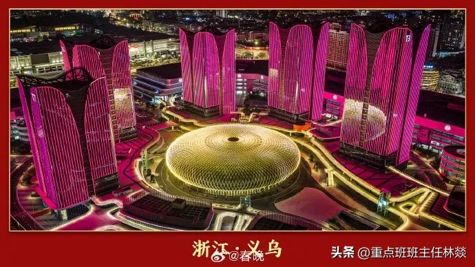
Yiu: topography and location of the business hub: east of the kim shao basin, zhe china geographic centre, zhekai railway, zhuekun high passage, river-net (you river, south river), corresponding to “the effect of the terrain on traffic and convergence”. Climate and agriculture: subtropical monsoon climate, rainy season, suitable for rice, sugar cane cultivation, providing a feedstock base for small commodity processing, linked to “climate effects on agricultural production”. Commercial geography: the global small commodity cluster, based on a long triangular industry cluster and logistics network, reflects “the impact of traffic location on business layout” and “regional industrial division and collaboration”. The link to the theme of spring and evening: “shots of silk”, reflects china's openness and economic dynamism。
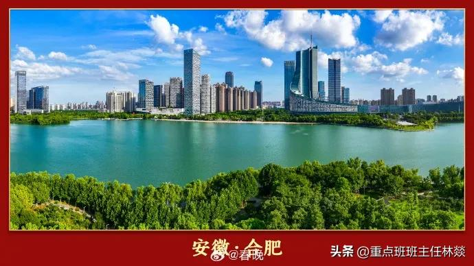
Fats: ecology and geology of the river's abdomen: the river is a watershed, the nesting lake (one of the five freshwater lakes) is the urban ecological core, with the yangtze basin accounting for 77. 2 per cent, the river basin for 22. 8 per cent, corresponding to “china's water system distribution and lake type”. Climate and disasters: subtropical monsoon climate, june-july rain, july-august drought, vulnerability to urban flooding, linked to “meteorological disasters and disaster prevention and mitigation”. Regional development: the long-triangular western wing portal, new qualitative productivity such as quantum information, new energy vehicles and so forth, reflects “scientific innovation and urban transformation” “joint urban cluster development”. Linked to the spring and evening theme: “creative empowerment”, demonstrating achievements in science and technology development and innovation。
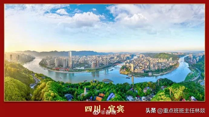
Ibein: the geographical endowment of the first city of the yangtze river gives the three rivers a flow: the jinsha river + the yangtze = the yangtze river, the starting point of the yangtze river, the wide gap between rivers and the abundance of hydro-energy resources, corresponding to “the development of the yangtze river basin and the use of hydro-energy ladders”. The terrain and climate: the southern edge of the sichuan basin, the main mountain hills and hills, the subtropical monsoon climate, average annual precipitation of 1142 mm, frostfree period of 335 days, suitable for bamboo and tea growth, associated with “the effect of topographic climate on vegetation and agriculture”. Industry and geography: white wine brewing (water quality + micro-organisms environment), power batteries (hydroenergy + lithium mining resources), reflecting “the impact of resource endowments on industrial layout”. Linked to the theme of spring and evening: “the wine is hymn”, integrating the yangtze culture, the ecology culture and the alcohol culture。
Trans-urban geo-relationship point climate distribution pattern: harbin (temperate monsoon) vs. The other three cities (subtropical monsoon) compared to “north-south differences in monsoon climate”, analysing the effects of latitude and land and sea positions on climate. Watershed synergy: fatty (lake of nest - yangtze) and ibein (upstream of the yangtze), linked to “eco-ecological conservation of the yangtze and coordinated development of the region”. Districts and development: harbin (border), yiu (trade and trade), cotttage (cobun), ibein (energy), reflecting a “localized regional development model”, corresponding to the “china regional development strategy” knowledge point。
Regional development and geo-spatial patterns: four major national strategies covering the revitalization of the north-east, long-triangular integration, the rise of the centre, and the two-city economic circles of the chengsu region reflect the coordinated development of the region in the “west-west north-south” and the concept of “localization” of the geographic disciplines. Human coordination: harbin ice and snow economy (climate resource utilization), eco-protection of feasty lake (wet rehabilitation), eco-governance of the ibein three rivers (the yangtze conservation) and green logistics (business and trade low-carbonization) are high-frequency cases of secondary school geography “human relations”. Geo-practical power: to guide students in comparing climate data from the four cities (average monthly temperature, annual precipitation), to map transport and industry linkages, to analyse the suitability of dwellings and climate, and to strengthen regional comparisons and integrated thinking。