As professional surveyors, we all know that the calculation of earth squares is a very important step in the construction work, and that the calculation of earth squares is required before construction. The calculations of earth squares can be divided into one phase of earth squares, two periods of earth squares, and a variety of methods, such as grids, barbed wires, shatters, dtms, regional earth squares and average high distances。
Scope of application of several earth formulas
Fragmentation
For long barline earthworks
The fault map consists of two parts, one part of the design line and the other part of the measured surface line. The area enclosed in the middle of the two lines is the area of the fault, and the design line on the measured surface line is a build-up of fillings, and the reverse square is a build-up of digs, which are filled with excavations。
Square grid method
Computation of earth-side excavations for levelling the site
The square grid-based earth equation is calculated by drawing small squares at a certain distance in the range of measurements, first calculating the amount of excavated squares within each grid, then excavating and obtaining the total amount of earth-based measurements and calculations。
Dtm law
For large areas with large ups and downs with highly volatile terrain
The dtm earth equation consists of four calculation formats, based on the coordinates of the document, according to the high distance points on the map, according to the triangle on the map and for the calculation of the earth over a period of two years, the first three are suitable only for the design of a plane or a surface with a slope, and the design of the soil on the two phases can be irregular and more used in practical work。
Consistency-based earth calculation
Applicable to calculating the earth's square between any two contours volume
Some cad graphics do not have high-range point data, and generally all of these maps have a contours, and the size of the two contours is known, and their high differentials can be calculated, so that the squares of two contours can be derived。
First phase of earth measure
Examples of methodological steps (triangular approach)
1. Conversion and copying of topographical map data formats
Map data from field measurements are exported into cass format and copied to the computer。
2. Open data files with cass
Opens the cass software and then clicks the drawing processing -- show side point number。
We will see the hint selection, select the plot scale at a time, default 1:500, press back to confirm the selected exported data file point and open it。

(if no graphics are shown, double-click the mouse-rolling axis and choose to do so, and then command zoom e
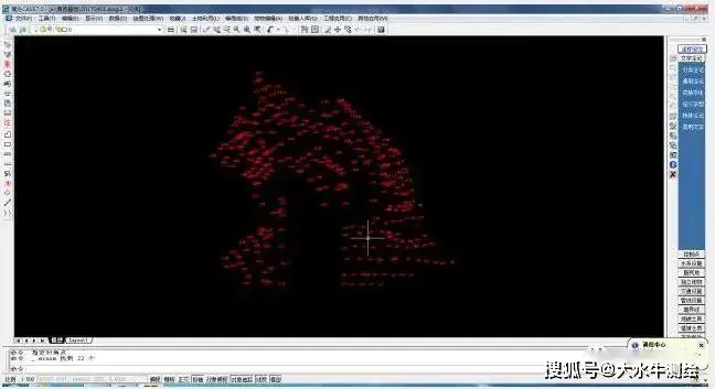
3. Establishment of the dtm act
Click on the plasma - create dtm。
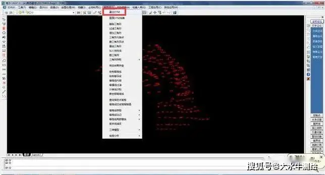
Select " generates from a data file " , and then selects the data file from the coordinate data filename。
4. Triangular network calculations
Click, the project applies -- dt, selects the formula for geometric calculations -- based on the triangle on the map -- and then suggests that the flat plant be marked high -- select all the triangles。
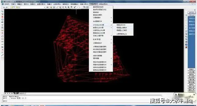
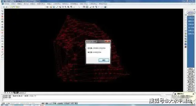
And then back to the car, the interface will show the amount to be filled。
Phase ii methods of calculating earth squares
Examples of steps (dtm)
The survey of the original topographical map of one side prior to the commencement of the project, the work in progress or final completion, would require a further survey of the topographical map to calculate the amount of the excavated square in it, which is the second phase of the earth equation calculation。
1 establishment of dtm
Opens the cass software, then clicks on the plasma -- creates the dtm。
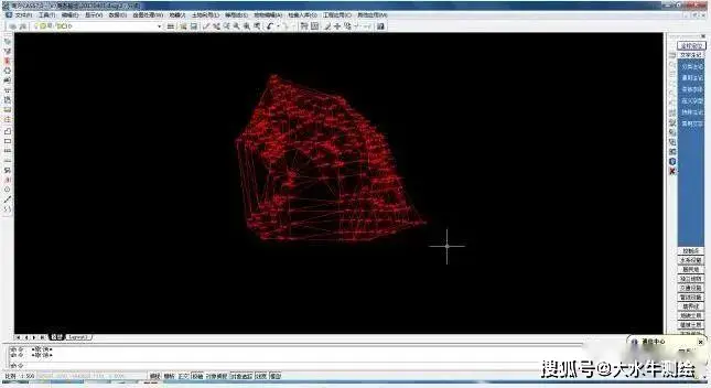
2. Write and save files
Click the plasma-tribe access-writing file, then save the filename, the default format of *. Sjw。
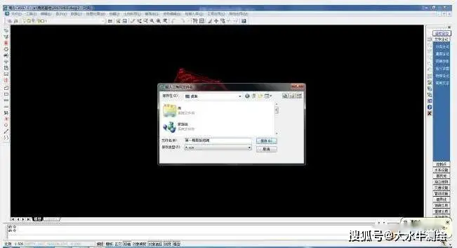
3 calculation of two periods of earth squares
Select the first triangulation file, then enter 2 and then click back。
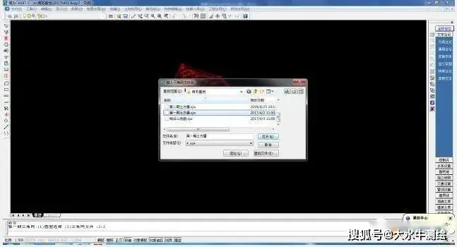
The pop-up window selects and opens the first stored earth triangle。
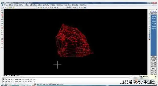
Select the second triangulation, enter 2 and return to the vehicle, and then select the second trig file。
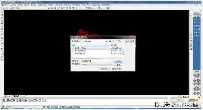
Click to open and calculate the two issues of earth squares。
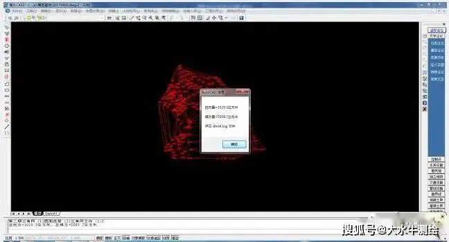
4. Identification and display of topography digs
Click to determine that double-click two mouse-rolling axes show the following picture of the two topographic maps filled in。
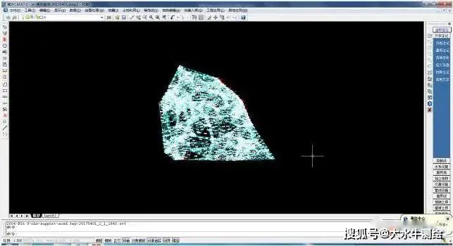
So if the original geomorphology of the first phase is large and the second phase is only part of it, then the amount calculated is the soil mass of the two phases of the relativities. The general primary landscape map is larger than the second map of the earth's square)。