Welcome
Pocket dictionary
This is a well-developed chinese technical terminological “small dictionary” column。
Here, we will promote the most fresh and authoritative scientific terminology。
Each issue of the subject, knowledge is not the same. Whether you wait for a car, lunch break or after tea, open the "packet dictionary" and learn some scientific knowledge at any time and place to make your debris time more valuable。
Hotspots, frontieres, practicals, everything! From artificial intelligence to life sciences, from astronomical geography to environmental protection, every term is the key to opening the door to knowledge。
Science, never so simple! A simple explanation that allows you to quickly understand complex professional concepts in easy reading。
We need to focus on the pocket dictionary
Let's become technocrats together
Chinese navigation day
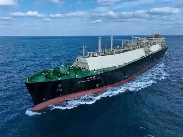
On 11 july, the 20th chinese day of navigation, the theme of which was “wise to sail the future”. Let's sail together, take a little boat with a pocket dictionary, swim the wonderful sea world and explore the treasure of the ocean
This pocket dictionary will focus on marine knowledge and lead you to the scientific terms that are relevant to navigation。
Let's learn, grow together, become explorers of knowledge of the oceans
Zheng and xiyang
Zheng he xi yang
Explanatory note: since myung-zu, eunuch zheng and her fleet have conducted seven long voyages to the countries bordering the south sea and the indian ocean. Launched in 1405 a. D., until 1433, when zheng and the sick were on their seventh voyage home. More than 30 countries and territories across asia and africa have significantly expanded ming dynasty's external relations and influence and represent the highest level of navigation technology at that time。
Navigational charts
It's not that bad
Interpretation: charts for the safe navigation and positioning of ships. These include general charts of maritime zones, charts of navigation, charts of coasts and harbours。
Navigation
Navigate
Interpretation: the ship is sailing at sea。
Balance rudder
♪ balanced ruler ♪
Interpretation: the rudder axis is located at a certain distance behind the rudder's lobe, which brings the rudder's central pressure line closer to the rudder's axis and reduces the rudder's twisting distance。
The mast
Oh, mast
Interpretation: the support structure at the top of the tower for the installation of the television and fm radio transmission antenna may consist of concrete or steel structures。
Marine survey vessel
I'm sorry, i'm sorry
Interpretation: the generic name of the various ships specializing in marine scientific research。
Coastal vessels
It's not like i'm gonna be here
Interpretation: ships suitable for navigation between coastal ports。
Channel ship
I'm sorry
Interpretation: ferry to and from both sides of the strait and between islands。
Inland vessel
Inland vessel; inland navigation vessel
Interpretation: ships sailing inland rivers, rivers, lakes and reservoirs。
Drainboats
No, no, no, no
Interpretation: a ship sailing on the surface of the water, the weight of which is entirely dependent on the floating force of the water。
All boats
I'm sorry
It's called a submersible
Interpretation: ships able to dive underwater。
We're flying up the deck
I'm sorry
Interpretation: a ship with an upper deck tectonic rise。
Solas international convention for the safety of life at sea
InternatioNar coNo, no, no, no
Interpretation: international conventions established by the international maritime organization on safety provisions for ships in respect of compartments, stability, mechanical and electrical equipment, fire prevention, detection and suppression, life-saving equipment and devices, radio reports and radio conversations, safety of navigation, grain shipments, shipment of dangerous goods and nuclear ships, to ensure the safety of life while sailing at sea。
Marine measurements
I'm sorry
Interpretation: a generic description of the various measurements carried out in marine areas and adjacent land areas, for which the ocean is the object of research. These include hydrographic surveys, coastal topography, seabed topography, marine geodesy, ocean gravity measurement, ocean magnetology and ocean engineering。
Marine geodesy
I'm not sure i'm going to do this
Interpretation: measurements to establish a land-control network of the ocean's extent, to determine the sea's gravity field, the sea's geodesy, sea surface topography and their changes。
Seabed control network
Sobmarine coNo, no, no, no, no
Interpretation: a network of seafloor control points laid in the sea area。
Submarine control points
Sobmarine coNtrol point
Interpretation: control points located on the seabed for the establishment of marine geodetic control networks。
Sea control points
Hydrogramic coNtrol point
Interpretation: the installation of a control point for hydrographic purposes along the coast based on a national control point。
Insular land survey
♪ island-mainland co ♪No, no, no, no
Interpretation: measurements carried out for the purpose of harmonizing the coordinates of islands and continents and for the calculation of the high range。
Chart baseline
♪ cart datum
Interpretation: altitude and depth from the top surface of the chart, including the high and depth base。
A seamless depth baseline
I'm sorry
Interpretation: continuous integrated bathymetric measurements and starting surfaces of depths contained in nautical charts。
Depth baseline guaranteed rate
Assuring nature of depth datum
Interpretation: the percentage of the number of low tides above the depth benchmark as compared to the total number of low tides over a period of time。
Local average surface
I don't know, local means sea level
Interpretation: the average of sea surface heights at a given location over a period of time。
Average daily surface
I'm sorry, but i'm sorry
Interpretation: average of sea surface heights continuously observed within one day。
Average monthly surface
MoI'm sorry, but i don't know what you're talking about
Interpretation: average of sea surface heights continuously observed during january。
Average annual surface
You know, annal means safe level
Interpretation: average of sea surface heights continuously observed in one year。
Years of average surface
I'm sorry, i'm sorry
Interpretation: average of sea surface height for several years。
Soundchart interpretation
I'm sorry, sir
Interpretation: estimates and identification of the height, size, nature and location of the target on the acoustic map。
Depth of the sea
Swearing depth
Interpretation: during the determination of the bathymetric survey, the bottom line of the cleaning gear is below the depth baseline。
Dry height
♪ drying bright ♪
Interpretation: the height of objects such as reefs above the depth reference surface。
Barriers to navigation
Other organiser
Interpretation: objects in the water, whether natural or man-made, that interfere with the safety of the ship's navigation。