Since the introduction of the tectonic doctrine known as the earth science revolution, this great doctrine has ruled over 50 years. Let's begin with a brief insight into the history of the science of plate construction。
The german meteorologist and geophysicist alfred lether wegener proposed continental drift in 1912Ntinental drift。
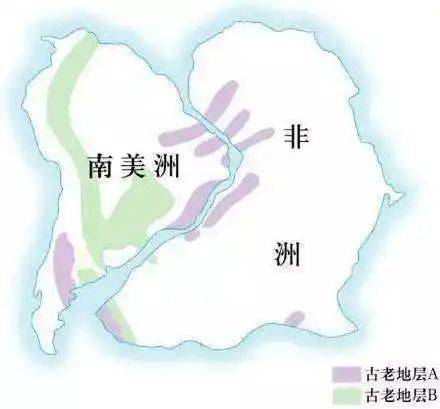
Continental drift map
In the early 1960s, h. H. Hess and r. S. Dietz advanced the sea floor expansion doctrine, which was further confirmed by the subsequent study of the seabed magnetic anomaly strip, the results of deep-sea drilling and the discovery of faults。
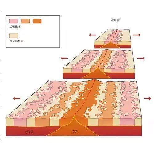
Map of the magnetic strip of the seabed
Map of seafloor expansion
In the late 1960s, earth scientists summarized continental drift (co)The results of the ntinental drift doctrine and the sea floor expansion doctrine, drawing on the new knowledge of the earth's inner rock and flounder circles at the time, have produced the plate tectonics doctrine, which has been hailed as a revolution in earth science。
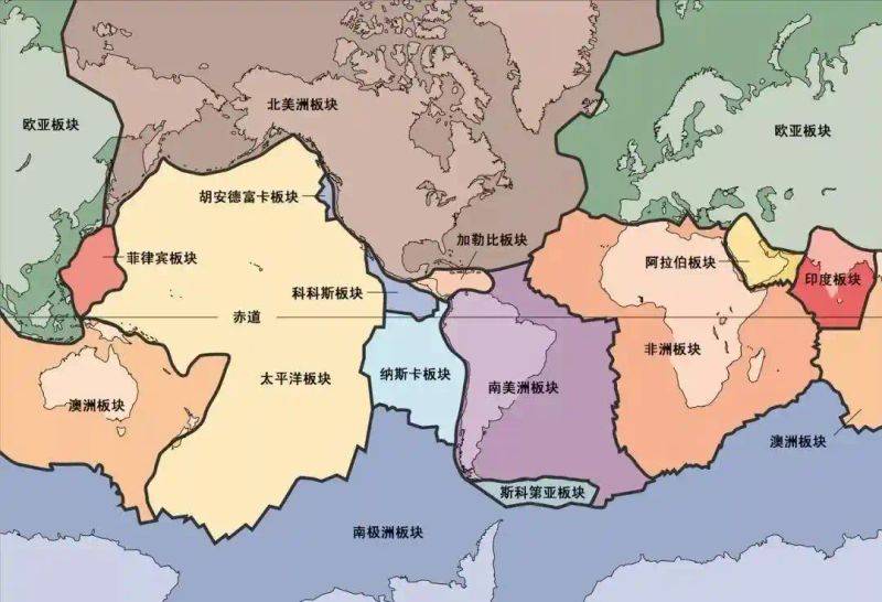
Map of global partitioning
The plate tectonic doctrine divides rigid rock circles into several different sizes, floating on more plastic flounders for large-scale manoeuvres, driven by convection of mantle material; the interior of the plate is relatively stable, and the edges of the plate are heavily tectonically active as a result of the interaction of adjacent plates, which are the main sites where earthquakes, magma activity, tectonic movements and deformations occur, while at the same time controlling geological processes。
Map of plate movement and plate boundary
Speaking of which, some of the little partners are going to ask, what is the basis for dividing the plates? What are the types of plate boundaries
Don't worry, let's discuss the type of boundary of the plate。

Earth scientists base the division of plates on different types of plate boundaries, dividing them into three types based on the relative direction of movement between the plates and their growth and decrease properties。
Separation plate boundary
(divergent plate baseary)
Also known as the constructive border (co)Nstruttive margins), i. E., two plates are moving back to the boundary, and mantle-contaminated substances constantly gush up along the border and add to the edge of both sides of the plate to form new crust. These are known as mid-ocean ridges, mainly in the atlantic, indian ocean and south-east pacific. The continental rift valley system has similar characteristics and is part of the dividing plate boundary, such as the red sea and east african rift valley systems。
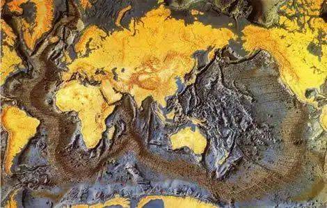
Topography of the mid-ocean ridge
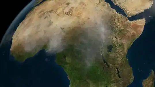
Red sea and east african rift valley satellite figure
Convergence plate boundary
(co)No, no, no, no
Also known as destructive boundaries, i. E., plates on both sides of the boundary move in relative motion and are squeezed, sprinted or collided. It can be further divided into two subcategories。
2-1 subduction:
The adjacent oceans overlap with the continental plate, which is generally reduced by the fact that it is less thick, dense and low-positioned, and thus falls below the continental plate. The subduction of the plate is mainly on the pacific perimeter and on the north-east coast of the indian ocean, also known as the extinction border。
The subduction boundary is further divided into two categories:
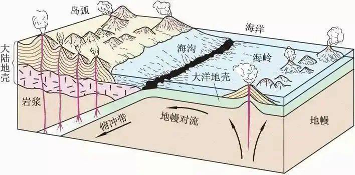
Island arc - trench
This means that the coastal trenches of oceanic plates are subdued beneath the arcs and continents that are separated by the basin. See mainly on the western and northern pacific margins. Also known as the western pacific continental margin or trench-argument system。
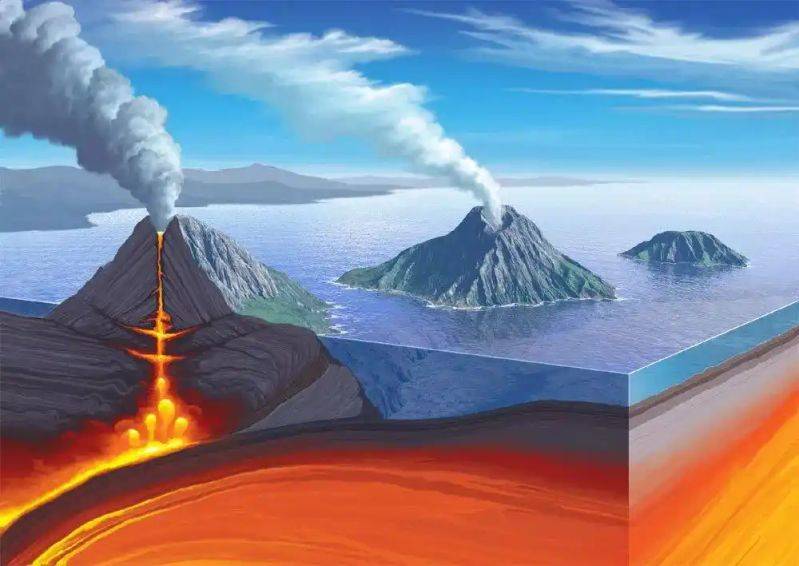
Island arc - trench
Mountain arc - trench
It means that oceanic plates dive below the arc along the land-based trenches. Seen mainly in the south american continental margin in the south-eastern pacific, also known as the andean continental margin。
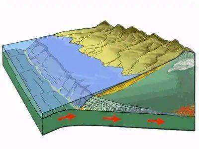
Mountain arc - trench
2-2 collision (collision) boundary
Also known as geo-sutures, are two continental plates colliding with each other, with closed oceans, and the crust of the land being squeezed into high mountain ranges, accompanied by strong tectonic deformation, magma and deformation. For example, the alps-himalayan tectonic belt is the collision boundary between the indian and eurasian plates。
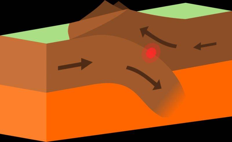
Map of land and land collisions
Square (cut) plate boundary
(shering)
Also known as transform faults, i. E., two plate boundaries are staggered horizontally, with no wrinkles, growth or extinction on either side, mainly in the ocean or on the mainland。
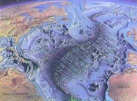
Mid-atlantic ridge and conversion fault
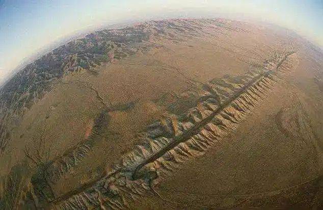
San andreas fault, united states, transition fault on the mainland
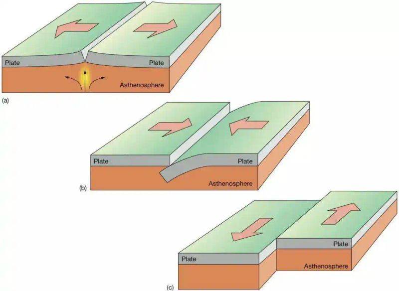
The last concise diagram summarizes the three categories of boundary described above:
A. Separation plate boundary
B. Consisting plate boundaries
C. Erected plate boundary (conversion fault)
References:
1. Shuyan tree. General geology. 3rd edition. Geology press, 2010.
2. Yang lun et al., concise course in general geology ... China university of geology press, 1998.
Editor: chang
== sync, corrected by elderman ==