Meteorological observation technology has undergone considerable development. Uav observations are now a reality. Uavs are particularly useful for high-altitude atmospheric data sampling at sea, as they are relatively easy to fly and adapt to the actual weather conditions of the location.
02. The emergence of remote sensing technology
Remote measurements of atmospheric parameters using remote sensing techniques have been widely applied in meteorological observations since the 1970s. A case in point is the meteorological radar, where electromagnetic waves launched with radar are reflected in rain, hail and snow, which allow for precipitation detection maps. A network of meteorological radars covering an area of over 100 kilometres. Today, europe has more than 200 meteorological radars, and the united states and japan each have similar numbers. The integration of meteorological radar data with weather forecasting models has been going on for many years, greatly improving the accuracy of weather forecasting。
Another means of remote sensing is the use of laser radars, which are similar to electromagnetic radars, but are launched by light waves capable of long-range measurements of aerosols in the atmosphere, namely atmospheric dust or clouds. Today, laser radar is used in all major meteorological offices。
03. Satellite observations
Another major advance in meteorological observation technology is meteorological satellites. With only one satellite, a vast area could be observed. Meteorological satellites fall into two categories: the first is a synchronous satellite, which is located above the same position in the equator (about 36,000 kilometres above ground altitude). Since single synchronous satellites cover only half of the earth's surface, their use for global meteorological observations requires multinational cooperation。
The second type of satellite is an orbiting satellite that continues to orbit the earth, approximately 300-800 kilometres above the earth's altitude and can orbit the earth every 100 minutes. Because flight altitude is only one tenth of the synchronous satellite, orbital satellites have higher resolution of the cloud layer and the ground, and because their orbit passes over the southern arctic, they can cover all latitudes en route and have the same resolution (as distinct from the synchronous satellite) at each observation point。
The satellite carries instruments to observe clouds, rainfall, aerosols, wind speed, temperature and humidity in the atmosphere at different wavelengths。
“recently, europe has successfully launched a new generation of geosynchronous satellites.”
In recent years, the number of meteorological satellites launched by humans has increased dramatically, generating ambitious plans, especially in europe. Last december alone, esa successfully launched a new generation of synchronous meteorological satellites。
04. Real-time observations
Finally, there is a tool known as “real-time observations” - some facilities are designed not for weather forecasting, but also for weather observation. Cellular networks, for example, have thousands of base station antennas in france, which use microwave communication. Operators found that microwave wavelengths could be affected if there was a rainfall area between antennas, reducing the reception level of antennas。
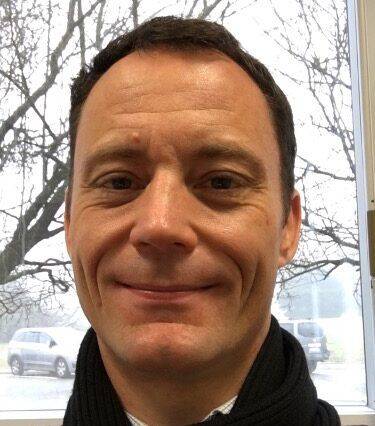
Pierre tabary, deputy director of operations, forecast operations, french meteorological service
Pierre tabary, deputy director-general of operations of météo france of the french meteorological service, explained: “the mobile phone operator was equipped with signal magnification equipment in response to signal decay, while the meteorologist was on a windmill, which detected signal decay, and was able to learn about precipitation intensity in the area and improve precipitation maps. Who would have thought in the first place that mobile phone networks were useful?"
Another example is the satellite positioning system, the united states global positioning system (gps) and the european galileo system. They would have been used for navigational positioning, “but these positioning satellites can keep sending signals, which can be slightly refractioned as they pass through the atmosphere, and the path becomes `curved'. The meteorologists also skilfully boarded the windmill: they launched a number of small satellites to receive positioning signals and measure their degree of bending, thereby obtaining thermodynamic data (e. G. Humidity) from the stratosphere and the upper troposphere.”
This measurement method, known as “radio occult”, has been validated by researchers, and dozens of such satellites are currently in use and the data obtained are entered into weather forecasting models for calculations. “the trick of this approach is that we do not have to send waves into the atmosphere ourselves, but rather use the waves that others send, which is `good and cheap'.”
Today, about 90 per cent of the data in the global weather forecasting model come from satellites and the trend will continue. According to tabary, “this does not mean, however, that ground-based measurements will be less important, as satellite data still depend on ground-based data calibration”
References
1. Lynch, peter; les origes de la prévision numérique du temps et de la modération climatique, la météorologie, 2008, no. 63; p. 14-2410. 4267
2. Wattrelot, eric, olivier camont, jean-françois mahfoufNo, no, no, no, no10. 1175/mwr-d-13/00230. 1. Meteo-01001390
3. Rey, gérard; traulé, olivier; bourcy, thomas; dubouchet, elisa
4. Stuhlmann, rolf, kenneth holmlund, johannes schmetz, hervé roquet and othersEumetsat – https://www. Eumetsat. Int/
5. Alpert, p., messer, h. & david, n. Mobile networks aided ourother monitoring. Nature 537, 617 (2016). Https://doi. Org/101038/537617e
6. Kursinski et al. 1997J. Geophys. Res. 102: 23. 429-23. 465.