China's food safety net information (wing zheng) indicates that the new cropland has become an important part of the agricultural land in the city of beijing. In order to enhance the orderly use of the new cropland, there is an urgent need to ascertain the quality of the new cropland. However, traditional soil quality testing methods require in situ profiling, sampling and indoor testing analysis, which is time-consuming and labour-intensive. To that end, a team of experts in soil assessment and quality upgrading from the centre for the construction and protection of crops in beijing and the food crops innovation team in beijing conducted a study on the use of mines for rapid, non-destructive and efficient detection of the effective soil thickness and profile structure of the new cropland。
What's mine detection
Mine detection is a means of detecting objects and geological phenomena using high-frequency electromagnetic waves. It sends electromagnetic waves from the ground through antennas to the ground, reflects through the layers or objects, is received by another antenna and is recorded in the form of a waveform of pulse reflection waves, and is processed to obtain a 2-dimensional radar image showing the vertical surface of the ground in grey steps or colour. Mine detection features are efficient, rapid, continuous, non-destructive, low-cost and high-resolution imaging。
How does mine detection work? How does it work
At present, the team of experts is using mine detection primarily to conduct testing tests on the effective thickness and profile of additional cropland。
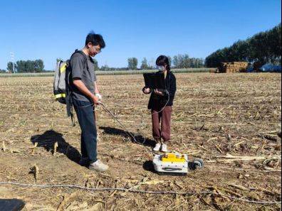
Radar field survey to obtain effective earth thickness
Use of mine detection to estimate effective earth thickness: use of mine detection to test additional arable land, use of water-bearing models to determine the average water content of the layers below each track line, and use of empirical formulas to predict the stratification constants. On the basis of the determination of the stratums, the effective layer thickness is estimated by using a combination of convulsive and radar-detected images to determine the area of active layer thickness。
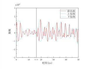
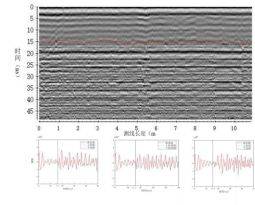
Photo from the agricultural rural advocacy centre, beijing city
(c) acquisition of profile configurations using mine detection: based on the availability of effective tectonic thickness, further demarcation of soil structure based on average amplitude envelopes and calculations based on average instantaneous frequency, based on radar line extraction of additional arable land. The results of the tests showed a maximum relative error of 4. 00 per cent when comparing mine detection to actual measurements。