The bridge was built and the river bended to the side. Such an awkward scene occurred in honduras, central america, which is not an example. If you look at it, the rivers of nature are crooked and, without interference, tend to bend until the two bends merge into a new channel. Why is that? There may be people who would say it out of their mouths: geo-diversion, but that is not the most important factor。
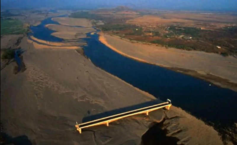
The shift forces the river to bend
Let's explain briefly what is called "terrestrial bias." you can imagine the earth as a high-speed spinning disk, and if you stand on it, it doesn't create bias. But when you throw a ball forward, it's still spinning, and this ball's old inertial speed, which doesn't keep up with the speed of the current disk, leads to a certain shift in the direction of the ball, which is the direction of movement。
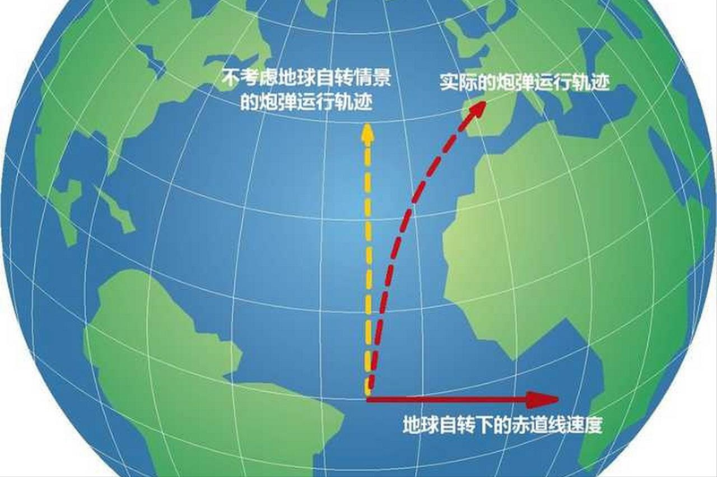
The general shift is towards the right in the northern hemisphere, to the left in the southern hemisphere, and to the equatorial zone. If we put this principle on the river, we find a river in the northern hemisphere, which tends to flush the right bank. On the left side, there is a shortage of water to flush and the flow is slow, which often leads to a pile of sand. The right bank has been eroded for a long time, the left bank has piled up, and the straight course has begun to bend。
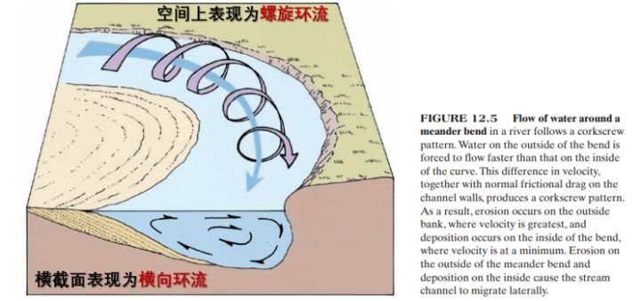
The transversal circulation washes the river
But geo-diversion does not explain some snake-shaped river lanes, both to the left and to the right, so the main reason why rivers bend is, in fact, the horizontal circulation hidden in the current。
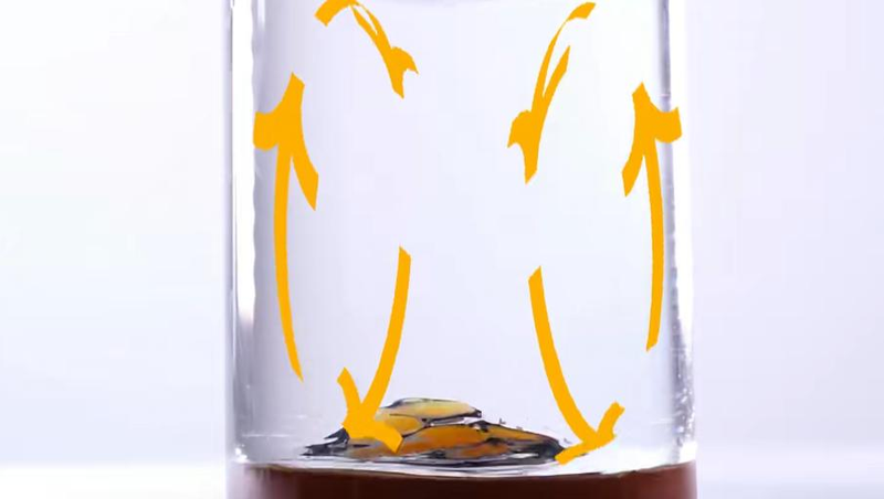
Horizontal circulations may sound strange, but we can see similar phenomena as usual. When we stir up a cup of tea, we find that the tea does not spread irregularly, but gathers at the bottom of the cup。

This is due to the fact that the current is being convoluted, resulting in a rapid centrifugal force in the surface, which concentrates on the same side. In order to balance the water missing on the other side, the bottom creates a horizontal pressure to move the water to the other side, thus forming a horizontal circulation。
The same is true for the river. The river is pulverized by sandstones in the river and flows forward in the form of a horizontal circulation. The surface water flow is particularly rapid and is constantly eroding the banks of the river on one side, forming a dimple. At the same time, the flow of water at the bottom runs from the dents to the cams, making up for the amount of water on the cams and, by the way, bringing the silt from the bottoms to the cams. As a result, the dents are becoming more condensed, the bumps are becoming more convulsive。
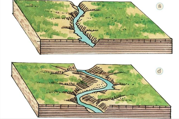
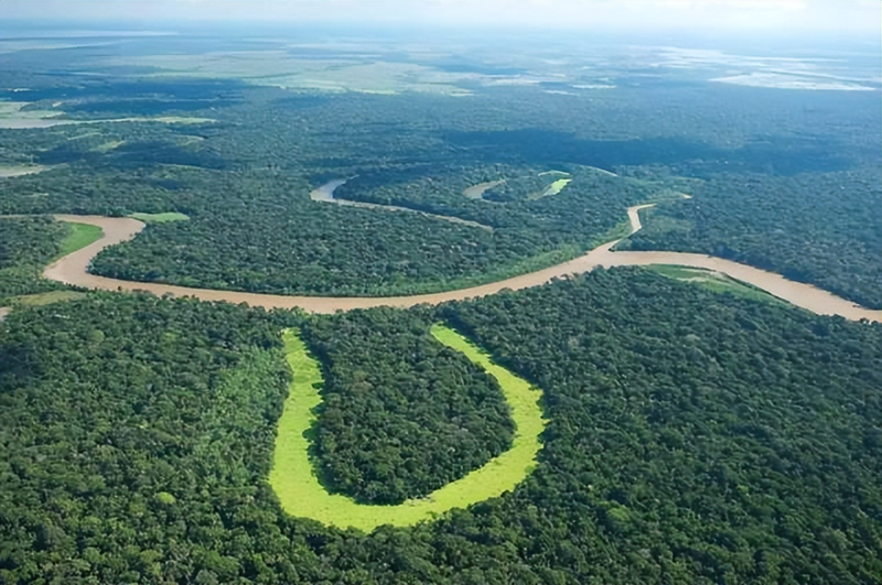
What is even more amazing is that if this situation does not intervene, the two adjacent turn points will get closer and eventually overlap. The current then follows a straight line, and the old bends of the river will slowly move away from the course and form a closed oxen lake。
Artificial embankments to prevent diversion of rivers
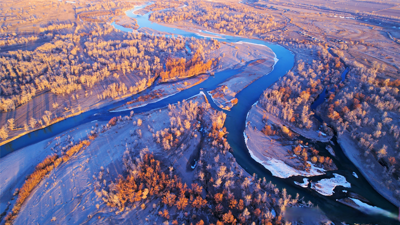
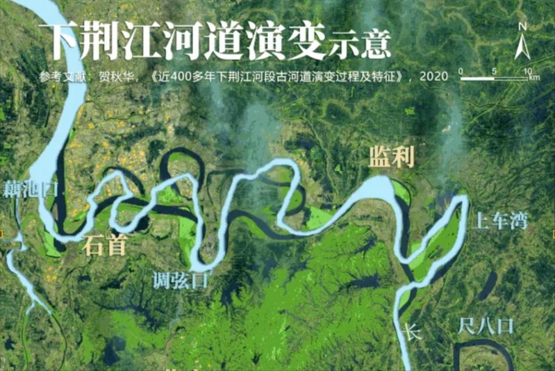
These can be seen in the yangtze region. The river is located in the area of the yangtze river, which runs downstream from the lake's north estuary to the lake's mausoleum, just as it moves from the tri-cany mountains to the plains. The rush of water produces horizontal circulation, leading to a very serious bending of the course. Although the river is 240 kilometres long, it is only 80 kilometres from a straight line, and it has 16 bends。
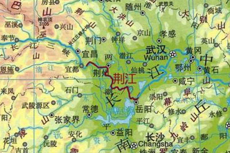
In addition, on both sides of the river, eight lakes were formed, including the lake of the moon and the lake of the great duke, all of which are relics of the river's ancient course。
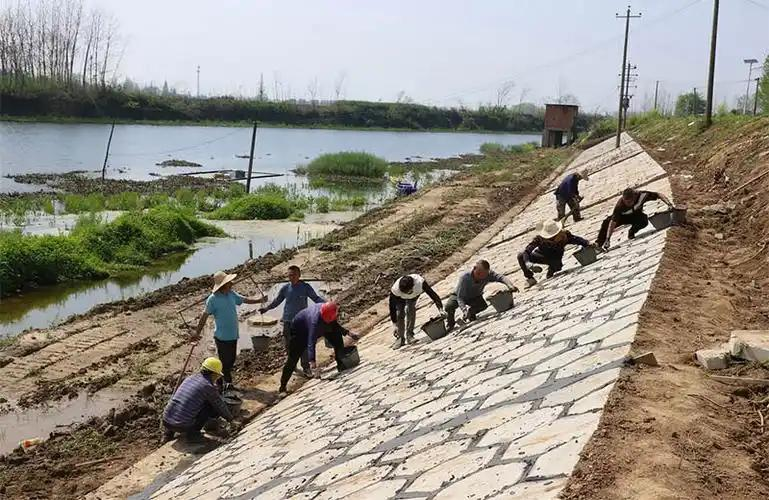
However, as humankind entered industrial civilization, more and more cities and agricultural lands began to spread along rivers. At this point, if the course turns again, it can easily cause some loss. As a result, dams and embankments are artificially constructed on both sides of the river to guide the river so that it does not turn. That is why it is very difficult to see river diversions today。
References:
1. Why do rivers always bend? — hainan department of geology
“the magical water experiment” no. 3: bended currents — upwater management
Horizontal circulation — china knowledge network
From "risk in the river" to "mais in the river", the yangtze embankments — the yangtze daily newspaper