A powerful, well-intended meteorological observation product is delivered directly to the forecaster's desktop and even integrated with the forecasting service system through an interactive mechanism
National and provincial forecasting services use weather processes for real-time testing and assessment of observation products, and observations and forecasts jointly contribute to high-quality meteorological development
Provide high-quality observation data for model forecasting, short- and short-range forecasting through rigorous use of equipment quality and observation data application end-quality customs
From 12 to 13 june, a strong cross-flow of weather brought hail and short-term heavy rainfall to kyojin and henan and shandong. At the beijing meteorological station, the meteorological detection centre of the china meteorological administration (hereinafter referred to as the “detection centre”) has placed radar specialists to interact with forecasting specialists in situ. In the rear of the detection centre, the team of technical experts is fully committed to using real-time operational platforms to secure equipment and data quality such as radars, soundings, ground stations and the x-band weather radar, ground-based remote sensing vertical observation systems and related algorithms for radar products to interact in a timely manner with the forward forecasting team to provide strong support for accurate forecasting and service precision。
China meteorological administration party secretary and director-general zhang guoqiang highly value the interaction between the centre and the national meteorological centre and provincial meteorological stations, and request that a summary of the work be carried out, that a mechanism be established for interaction be established, that the application and dissemination of meteorological services be strengthened and that the quality of observation services be improved。
How is 1+1 greater than 2
On 12 june, before the strong currents affected the beijing region, the chief inspector-general of the radar applications unit of the centre for detection (radar meteorological centre) was placed at the forecasting conference platform of the beijing meteorological department to provide technical support for the forecasting team to “read” the observation products, provide accurate forecasting of the process and issue timely warning of forecasts。
During this process, the combination of thunder, wind, hail and short- and short-lived precipitation was extremely complex and varied, requiring the “capturing” of key details hidden in observation products, which was not easy。
The key to effective human interaction is the full exploitation of key information that can be found in weather radar and multi-source meteorological observations, as well as the experience of monitoring early warning operations in practice, understanding the actual needs of forecasting operations based on the application and testing of their presence, and exploring improved radar algorithms。
For example, radar is like a front-line outpost to watch it. Before the convection system entered the beijing region, the twilight noted the evolution of cold vortex clouds and the development of the upstream radar echo, analysed the rich information contained in its products and interacted in a timely manner with forecasting experts。
At 1600 hours on 12 june, the wiring convection system “main force” developed from north-west to south-east and formed a fast-growing backlash around 1730 hours in dense clouds and huairou. At about 1830 hours, the superstitious monomer continued to develop, forming a clear mercuric cyclone and a deep, strutting, strong echo core. These dangerous signals indicate that hail of larger diameters has formed。
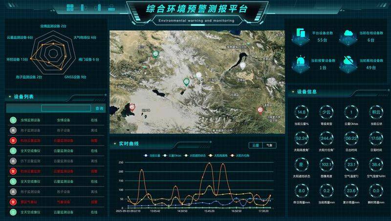
When these dangerous signals are discovered, the zoo interacts with the forecaster in a timely manner. In the common application of observations and identification of products, radar experts with algorithmic principles and power mechanics, and forecasting experts familiar with weather processes and patterns of evolution, interacted, interacted and worked together to achieve 1+1>2 effects。
Indeed, not only is there a real-time interaction between detection technology and observational predictions at the site of the beijing meteorological station, but the real-time interaction between detection technology and forecasting has not stopped for a moment after the china meteorological service launched the storm-storm 4 emergency response. Using the albatross system and the new generation of weather radar operating software, the detection centre strengthens real-time monitoring of catastrophic weather, such as heavy rain, wind, and interacts in real-time interaction with the central weather station's strong weather forecast centre and the beijing, shandong, jiangsu, henan, hubei and provincial (municipal) meteorological stations to support and test alerts near forecasts, using the latest realities, such as heavy rainfall, hail, and third-dimensional monomer monitoring。
How can forecasts and services be better supported
Behind the observation and forecasting interactions are stringent requirements for quality of equipment and quality control of data such as radar, sounding, ground stations, etc. The chief of the data quality unit of the detection centre, zhao petao, introduced over 7,200 electromagnetic interference and fault malpractice quality controls of emergency area weather radars by the system, over 40 artificial errors, processing 182 precipitation anomaly alerts and ensuring that observation equipment is functional during the emergency meteorological security service, that data are useful and that observation services are forecast to support the operation。
In response to the super-single storm that caused severe hail disasters in huairou, the radar meteorological centre, in active cooperation with the beijing city meteorological department, carried out precision observations of the storm using x-band weather radar in the framework of a radar observation experiment deployed by the integrated observation division of the china meteorological service, achieving coordinated multi-band radar observations of key targets and continuously monitoring the entire process of hailing, enhancing and falling in the air。
This is as if a reconnaissance aircraft capable of close observation would have to be sent in order to map the critical forces of the other side on the battlefield and scan every nuance in the core area. These details provide both technical support for hail and its mobile path judgement and build up valuable scientific data for the development of mechanical studies such as hail and the identification of extrapolations. This effective exploration will be extended to more pilot provinces, as radar observation experiments continue to advance, and will be used to promote and apply strong transversal processes, such as cyclones, thunderstorms and short- and short-lived precipitation, to create a good interaction of forecasting and observation rings。
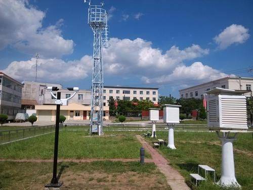
The rapid pace of weather-flowing processes cannot be described as “ghostless”. Despite its abundance, current detection techniques are still inadequate and require the help of ground-based remote sensing vertical observation systems。
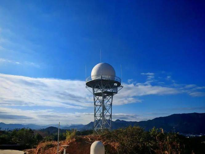
The centre's base room is currently being studied by a senior engineer, guo kai yun, and the ground-based remote sensing vertical observation system, consisting of wind profile radars, millimetre wave cloud meters, microwave radiometers, aerosol laser radars and gnss/met, provides continuous ground-to-troposphere observations of atmospheric temperature, humidity, wind, water condensation, aerosol contour lines below the top of the troposphere, which are used to compensate for the deficiencies in the subdensity (2 times a day) of detection observations, often as an important means of mapping the entire weather evolution process。
In the course of this process, the centre developed a refined vertical contour integration product, such as temperature flats, low air currents, cloud water phase recognition, which clearly “describes” the process of strong currents affecting beijing and its surroundings, providing important technical support for precipitation identification, phase conversion, strong current potential forecasting, etc。
In fact, vertical contours integration products also play their rightful role in ensuring meteorological services at the beijing winter olympics and the winter paralympic games in 2022。
The interaction of observation and forecasting services is a concrete expression of “people above all, life above all” and an important practice of high-quality meteorological development. As a next step, the centre will further refine the interactive working mechanism for observational forecasting, strengthen the direct access service for observational service products, observation equipment and data quality information, and use the technical mechanism for disaster weather round-ups to draw lessons and refine mechanisms to enhance their application in the provision of services for periods and major events。