The integrated geomorphological analysis is indeed a core building block in high-level geology, not only to look at the memory of underlying concepts, but also to test the ability of people to integrate knowledge of internal forces, geological timescales, regional characteristics, etc., and to explain the process of physical formation. This component is becoming more flexible and integrated in the light of recent trends in high examinations。
I will now provide you with a systematic overview of the geomorphological synthesis of the geographies of the high examination, taking into account the four dimensions of the situational trends, the core knowledge systems, typical landscape cases and the generic response template。
I. Recent trends and directions for the examination
Based on an analysis of the 2024 high examination and a projection of the 2026 pre-test, the geomorphological component shows the following characteristics:
1. Emphasis on the formation process: it is no longer satisfied with simple geomorphological identification, but requires the geographical process to describe the formation of the landscape, such as the formation of river slopes, ripple beaches, alluvial fan formation。
Multi-factor synthesis: the physical features are examined in conjunction with factors such as soil, vegetation, climate, hydrology, etc., to analyse the interactions between the various geographical elements. For example, how vegetation cover affects landscape development or how landscapes affect local climates。
3. Focus on hot spots
(1) global change: in combination with global warming, examine geomorphological changes caused by melting of frozen soil and the impact of sea-level changes on coastal landscapes (e. G. The evolution of estuaries and deltas)。
(2) geological disasters: taking into account regional topography, climate, the conditions, effects and prevention of disasters such as landslides and mudslides。
(3) new features: mechanisms for the formation of special features, such as potholes of rivers, nested lake landscapes, etc。
Ii. Core knowledge systems for integrated landscape analysis
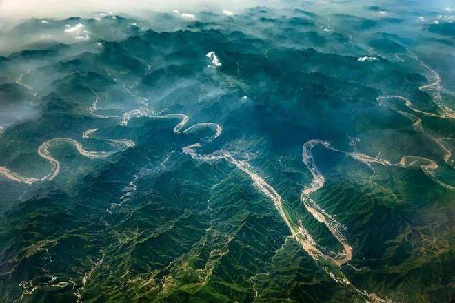
An analysis of the landscape must firmly capture the fundamental principle of “complementing internal and external forces”. The vast majority of landscapes are shaped by external forces (carving) based on internal forces (laying patterns)。
A formula can be used to understand it:
Topography = base rock (sedimentary, deformant, magma) + geological activity (internal, external) + time

Iii. Analysis of the formation process of the typical landscape of hf
The key to solving the problem is to have a history of specific features。
River level
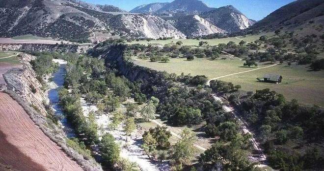
(1) formation process: during the period of relative stability of the earth's crust, rivers are dominated by side erosion and piles, forming ripple beaches. It was followed by a massive rise in the crust and increased sub-river cutting, with the old river beach being higher than the flood level and forming the steps. The earth's crust was then stabilized once again and the rivers piled again. So many times, they form layers。
(2) key points: the greater the number of steps, the greater the number of liftings of the earth's crust, and the earlier the step, the earlier the formation。
2. Alluvial fan
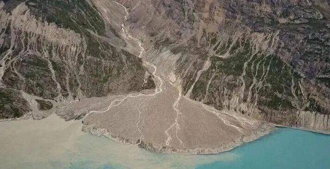
(1) formation process: in the mountains, the steep terrain and rapid flow of water during the flood period are accompanied by large quantities of mud and gravel. When the water flowed out of the mountain, the terrain suddenly subsided, the river opened, the flow slowed, and the material it carried gradually piled up in the mountains, forming a sector-sized landscape。
(2) key points: from the top to the edge of the fan, the terrain is reduced, the flow rate slows down, sediment particles are finer and groundwater is buried deep and shallow, often forming oasis。
3. Caste landscape (in the case of dissolved holes)
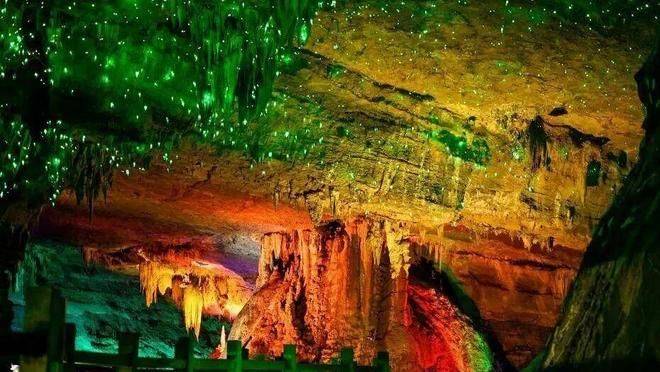
Process of formation: in the marine sedimentary environment, deep, soluble limestone layers are formed. The crust rises and limestone rises out of the surface. Carbon dioxide-rich water, which penetrates along the limestone cracks, causes erosion and formation of dissolved holes, underground rivers, etc. When calcium carbonate-rich groundwater drops from the top of the hole, the water evaporates, carbon dioxide escapes, calcium carbonate is re-depositioned, and the accumulation of the day and the day forms the stone clock's milk, rock stubble and pillar。
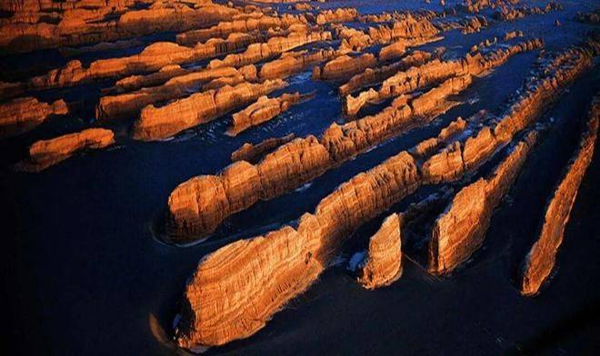
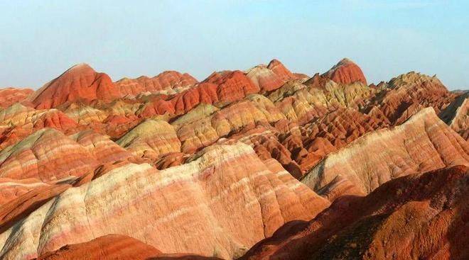
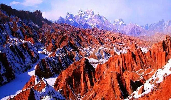
4. Dansha landscape
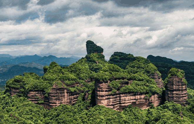
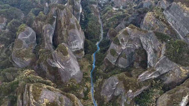
Formation process: in a land-based sedimentation environment, deep red gravel layers are formed. It is then lifted by the hull movement, resulting in fractures and rhythms. Under the combined effect of water erosion, wind erosion and the collapse of gravity, they are cut to the surface in the form of castles, pagodas, needles, columns, sticks, square mountains or peak forests。
5. River invasion
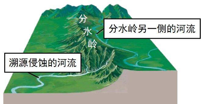
(1) formation process: as a result of the erosion of two adjacent rivers, one of them (the invasion of the river) has a wide margin of divergence, has a strong capacity for retroactive erosion, stretches upstream and eventually cuts through the watersheds, taking the upper part of the other river (the invasion of the river) and bringing it into its own territory。
(2) key points: as a result of the invasion, the river is becoming more water-intensive and more erosion-capable; the river is shifting upstream, and the river is becoming a guillotine river downstream。
Iv. General thinking and response template
1. Three-step strategy
A three-step approach to geomorphology analysis allows for the following:
Step 1: a dominant factor. Whether the landscape is largely shaped by internal forces, external forces or both。
Step 2: analysis of specific processes。
(1) internal force is predominant: describes how the rock formation (sedimentation), how it is deformed (the crust movement leads to wrinkles or faults) and how it is exposed (the crust lifts)。
(2) external force is predominant: description of what the affected substance is, what kind of external force (flowing water, wind, glaciers, waves), and the specific behaviour of the external force (e. G. Flow erosion, wave extraction, wind erosion, flow slowing accumulation). It is described in accordance with the logical chain of “generic-erosive-steal-accumulation”。
Step 3: group answer terms. The answer is logically organized in the normative geographical language in chronological order。
2. Example of the answer terminology
(1) back slopes: the formation of a back slope at the tip of the back slope, which is subject to tension, the rock is broken and vulnerable to erosion into the valley。
(2) delta: rivers carry a large amount of sediment into the oceans, which accumulates as a result of the low level of the terrain and the presence of seawater (the lake water) and the slow flow of water。
(3) sea erosion poles: waves increasingly erode the coast, form sea erosion dens, sea erosion dens expand, upper rock collapses, sea erosion cliffs retreat, and remaining hard rock bodies form in the open sea。
(4) granite outbursts: limestone deposited under the seafloor, modified to form marble, rear crust lifted, upper rock layers eroded by weather, and marble out of the open surface。
V. Easier to be wrong
Ignoring time scales: the formation of landscapes often takes more than a million years of geological time, with a sense of “geological history period”, such as “geological history period, where the sea is the place where limestone is deposited ...”。
2. Internal and external confusion: strictly speaking, all landscapes are the result of a combination of internal and external forces. Questions are to be answered in a single order, but not just one. For example, the analysis of the mew plains refers to both internal and external forces (the sedimentation of rivers)。

3. Misjudgement of the old and new relationship of the rock layer: remember the core principle: the new and old of the covered; the new and the cut. The intruding rock was later than the formation of the rock that it invaded。
4. Interpretation of contour topographic maps
(1) magnificent: caught in valleys (valves, developmentable rivers) and ridges (ridges, watersheds)。
(2) the value of the closed zone: when the closed curve is between two isobaths, it is judged by the principle of “greater, smaller than small” whether the hill or the low。