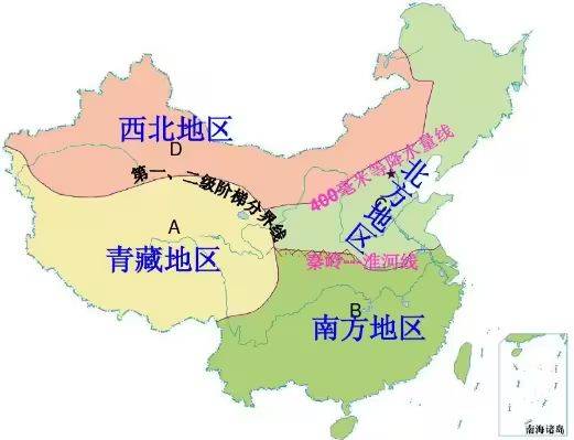
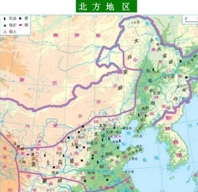
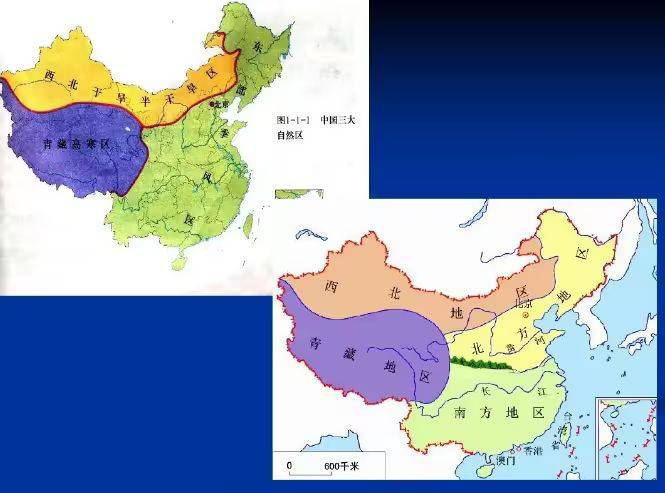
The northern region refers to the vast areas north of the qinqing-wi river, south of the inner mongolia plateau, east of the heung ainginging hill, and south of the qing tibetan plateau,3 mainly covering the north-east and north-west china。
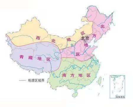
Four geographical regions
In terms of administrative divisions, these include heilongjiang, jilin, liaoning, beijing, tianjin, hebei, shandong, shanxi, shaanxi (excluding shaan nan), henan, henan, jiangsu (zizhou, lienyun harbour, cebu) and anhui. Four
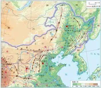
Topographic maps
The northern terrain is dominated by plains, but also highlands and mountains。
The north-east plain, the largest plain in china, is situated between the long white mountains and the heung-aming hills and the little-hing-aming hills. It is made up of three parts of the pine plains, the three river plains and the lia river plains. The soil is the most fertile black soil。
The northern plains of china are located south of mount yan, east of mount taishan, north of the wai river and near the sea to the east. The northern plains of china are alluvial plains formed by sedimentation from the yellow rivers and rivers held hostage by them during the geological history period, and the soil is yellow。
The yellow-turkish plateau is located on the western side of the taiyan mountains, on the east side of the ogry ridge, on the south side of the inner mongolia plateau, along the border between the great wall and north of qin ridge. The yellow soil here is the result of wind deposition during the geological history period. At that time, strong northern winds were blowing sand and dust south. As the wind subdued, the sand sanctuaries formed a flat, high-level yellow earth. Subsequently, with the extensive destruction of the vegetation of the yellow plateau and the brushing of loosed yellow soil, the soil has been severely eroded, resulting in the formation of tumbled yellow hills (yowsakawa, yowsa, yowta)。
The northern part of china is dominated by the northern temperate zone, which has a monsoon climate. The climate is characterized by clear seasons of the year, high summer temperatures and rain, and cold and dry winters。
The northern region is characterized by annual precipitation of 400-800 mm, concentrated in the months of july and august, with heavy rains, during which the river surges and rivers become prone to flooding, while the annual spring season is characterized by low rainfall and frequent droughts (hard spring and summer rains)。
Since 1992, with the exception of 1998, the northern precipitation has been below the multi-year average in february-april. At that time, the effect of la niña was that the northern region of china was prevalent, while the south-eastern part of china was characterized by relatively weak warm and wet air, which, combined with the adverse effects of warm and warm air, had not been able to create the desired rainfall conditions in the northern part of the country, resulting in sustained rain and drought。
During the same period of hot weather in the north, crops are suitable for growth. Some provinces are food-producing provinces, such as heilongjiang (the highest output), jilin (the highest output), henan, shandong and liaoning。
Crops such as maize, rice, soybeans, sorghum and spring wheat are mainly grown in the north-east, while crops such as winter wheat, maize and soybeans are grown in the north-east。